


On August 1st, 2013 a large chunk of underlying ice on Grasshopper Glacier in the Wind River Mountains broke loose and slide into Downs Creek, flooding the entire valley and stranding a family on a pile of boulders. This is a main trail into the eastern side of Gannett peak, a favorite route for climbers. The bridge over Downs Creek on the Glacier Trail was overflowing with water and debris, so much so that hikers had to cross the creek waist high there. Luckily, this is a slow spot on the creek so crossing is safe.
Downstream at Dinwoody Creek, after the confluence of the two rivers, the flow was dangerous. Usually low and crossable at this time of year (there is an alternate trail to the Ink Wells Lakes at this creek crossing), Dinwoody Creek was a roaring cauldron of milky green waters.

The endless slog up the steep switchbacks
The Glacier Trail is not for the faint-hearted or under prepared physically. The first ten miles, the trail rises 3,000′ with little potable water. The old trail, taken out by an avalanche, is now a stock route; while the new trail uses a series of 29 switchbacks to ascend a seemingly vertical rise. That’s the first day although I broke it up with a stay at Bomber meadows 3 miles up from the trailhead.

At the pass looking down into Burro Flat. 11,000 feet
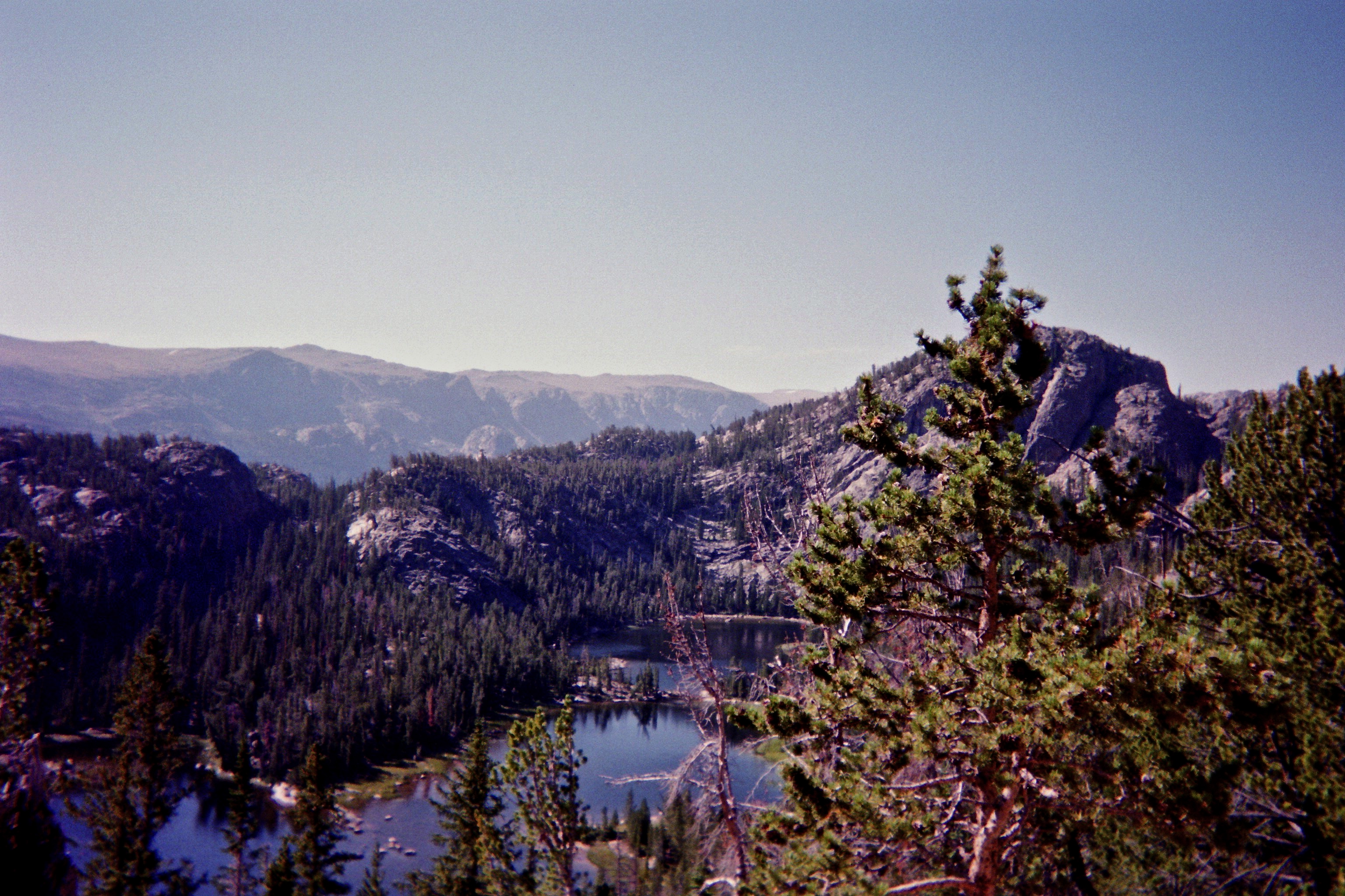
The trail ascends to an 11,000′ pass which has the illusion of constantly receding it’s so empty and vast. A short descent after the pass finally takes the hiker to Dinwoody Lakes, a group of pristine lakes held within ice-carved rock and pine walls. There was a large burn here not long ago and thousands of dead, mostly white-bark pines, stand stark amidst the new undergrowth.

Phillips Lake was heavily burned
But you aren’t there yet.
Continue on your journey up to another pass at Star Lake. I think this lake might be barren as I never saw any fish feeding here. A Forest Service crew was here for the summer doing trail blasting work. Although camping was prohibited because of their work, the crew had taken off for the week and I camped at this lovely lake at over 10,000′. The White Bark pines leading from Double Lake to Star are in good shape. The unfortunate fire that killed so many of these critical pines, whose seeds serve as bear food, probably slowed the beetle infestation on the west side of the fire.
Honeymoon lake on the descent into the valley
From Star Lake you begin your 1000′ descent on tight rocky switchbacks into the Dinwoody Valley and Downs Valley area. I never intended to go to Gannett–I’m not a peak bagger or climber–but I did want to go to the Ink Wells. I didn’t quite make it there. I’d already used up five days, and spent the next two days exploring Downs Creek valley and Dinwoody valley. Then a large storm system blew in. With little food reserves to hunker down with, I made the decision to hike out. Yet my short stay allowed me to witness the effects of the massive amounts of glacial silt that came pouring out of the icy peaks of the continental divide.

Look at the forest floor. That is all glacial silt.
The 3 mile hike up Downs Creek had glacial silt on the entire forest floor, in places up to two feet deep. Shrubs that were 3-4′ high had been covered completely with silt until the water had receded. I was there on August 6th, seven days after the event took place. By then the water had receded and was flowing furiously in the river channel. But the silt was still wet, and in the evenings, after the warm days, the river rose higher. In places I would step into ‘quicksand’, get stuck in the glacial mud above my knees. When wet, the silt was like a sticky green mud. Dry, like sand.

Dinwoody Creek. Koda finds a drink. The river ran so fast I had to keep him away.
8,200 years ago, a lake larger than any in our modern world filled the area around present day Great Lakes and Canada. Lake Agassiz was, at times, as large as the Black Sea. When the Hudson Bay ice finally retreated as the climate warmed, Lake Agassiz broke through the dam, quite suddenly, draining completely down through the Mackenzie river drainage into the ocean. It was a biblical event, probably killing everyone in its path, rising sea levels up to 9 feet, and changing the world’s climate.
On August 6th 2013 I stepped into the aftermath of a mini-melt, a micro-glacial event that demonstrated the power of melting water on an ecosystem and people. Worth noting is that the bridge at Downs Fork, built by the CCC in the 30’s, stood firm until 2003 when Grasshopper Glacial had its first melt event and took the bridge out. The bridge was rebuilt, but now only ten years later, a second event damaged that bridge again. The stranded family was rescued by the forest service crew. Amazingly, no one was injured or killed by the rushing waters. Yet somewhere between my awe and investigative curiosity lay my real question: As more of these events occur–bigger than this one–what will our world look like?

Beginning–or ending?–the trailhead. One way in and out
Filed under: Wind Rivers | Tagged: Dinwoody lakes, Gannett Peak, Glacial event, Glacier Trail, Grasshopper Glacier, Wind Rivers |

Even when we use to backpack in our younger days, we never did on walk quite like this one. I found it a fun read, although also alarming. The photo of the forest with the glacial silt tells another alarming tale of glacial melt.
LikeLike