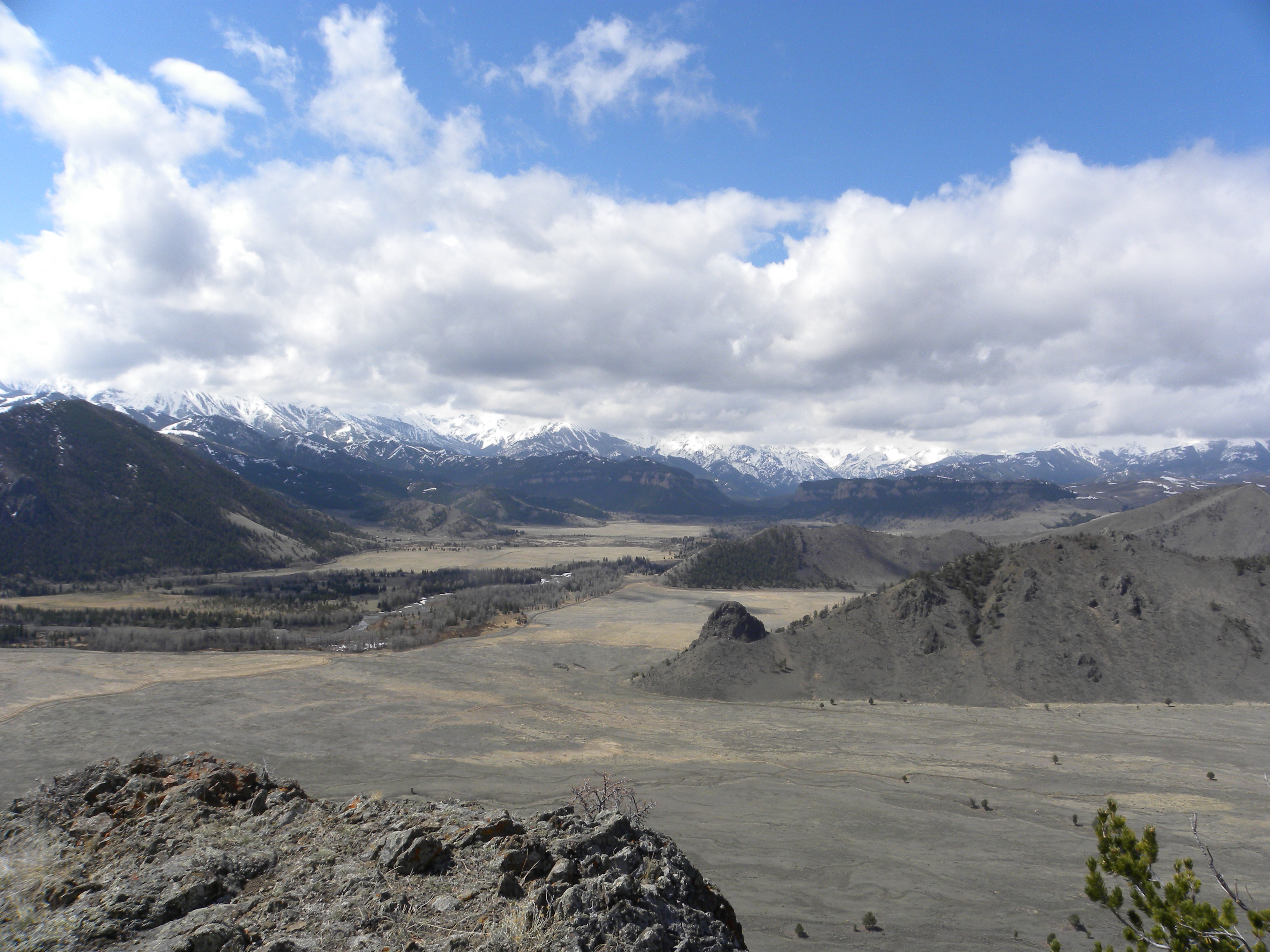
I spent the last month wandering through Southwest Anazasi ruins, specifically around Bluff/Blanding in the Cedar Mesa area. With the help of a guide book, and the local who owned the motel I was staying at, I explored as many petroglyph and ruin sites as I could, given that the mesa had quite a bit of snow and many roads were impassable clay.

This guy never got out in the sticky red clay, even with all our help
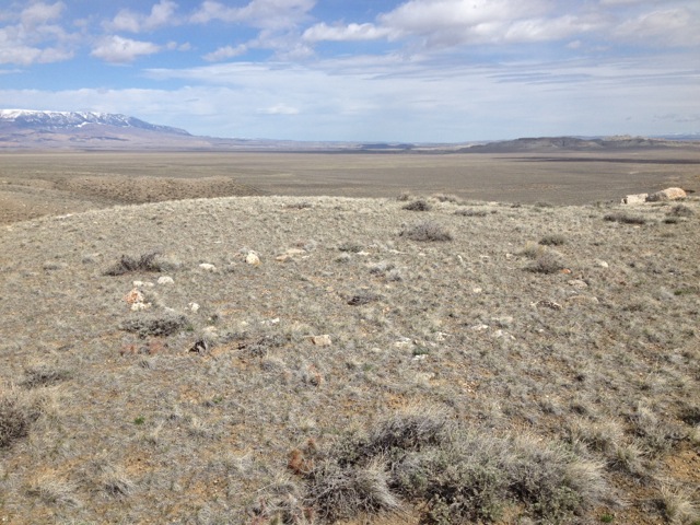
Cedar Mesa area is unique amidst cultural Anazasi sites. Its a BLM study area that probably had a population 2-3 times that of today; that would be easily 10,000 people living there. And it shows. Hike down any canyon and you will absolutely see granaries, old stonework and dwellings, kivas. In short order, anyone will be able to judge what topographic features would attract an Anazasi dwelling: south facing cliffs, high alcoves, inaccessible nooks with some access to water. Some of the ruins obviously housed many families, while others were small and may have held only a few. Invariably though, they’d be a kiva always there, sometimes several. These were community meeting rooms and the general size of the mesa kiva seemed like it could house no more than ten comfortably.

Large extensive alcove run

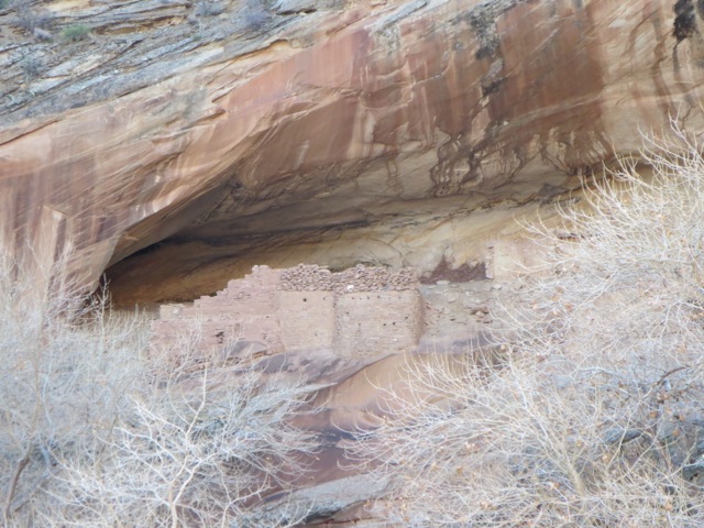
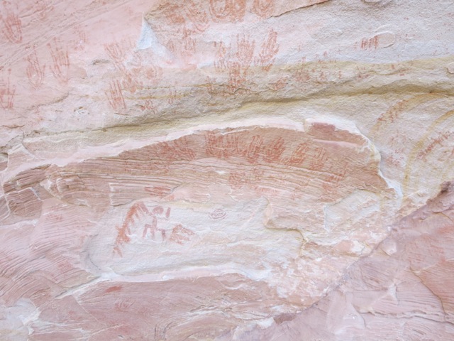
View of ruin approach. The ruin is right at this large pour off, difficult to access purposely for defensive purposes. You can see the ruin on the right side. The left side of the pour off has a small alcove with handprints and grinding stones, below.

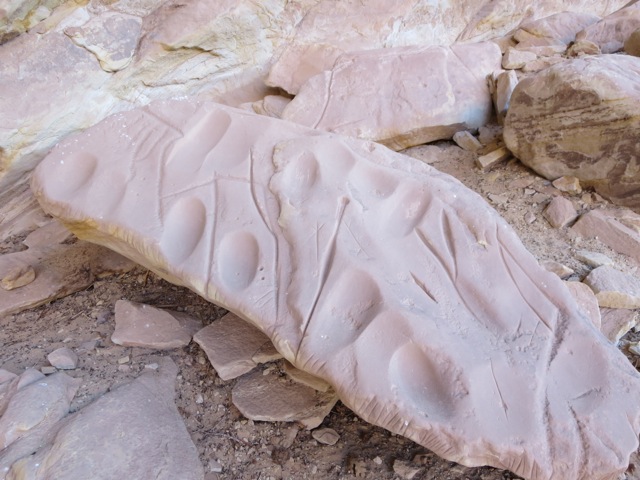
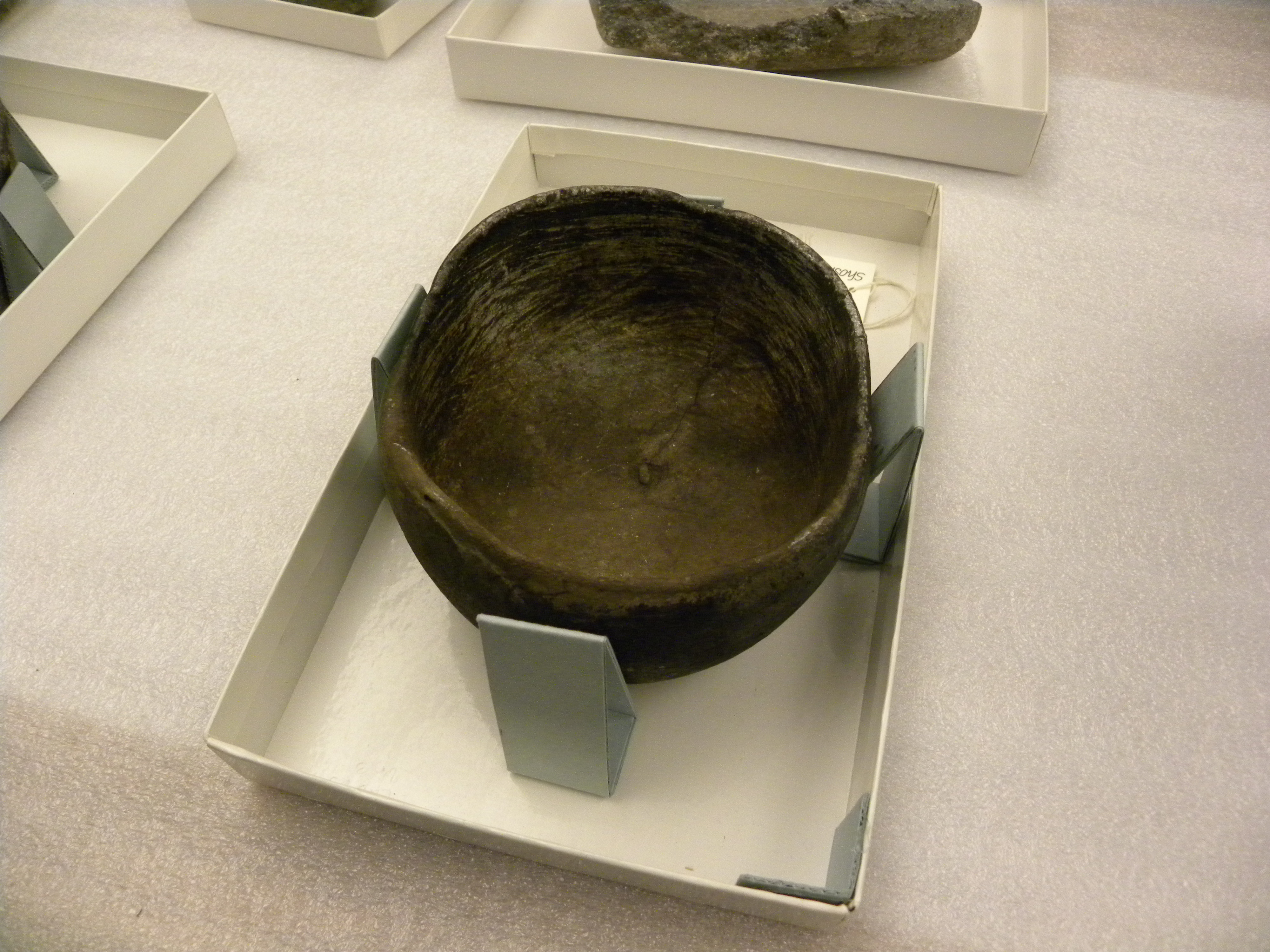
Corn grinding stone. A common site within dwelling areas. Also cuts where axes were sharpened

I fantasized that women were grinding the corn, and when their hands got too muddy with red clay, here they went to clean them off. Many handprints also had the familiar spiral inside
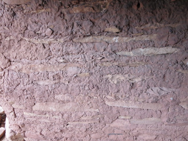
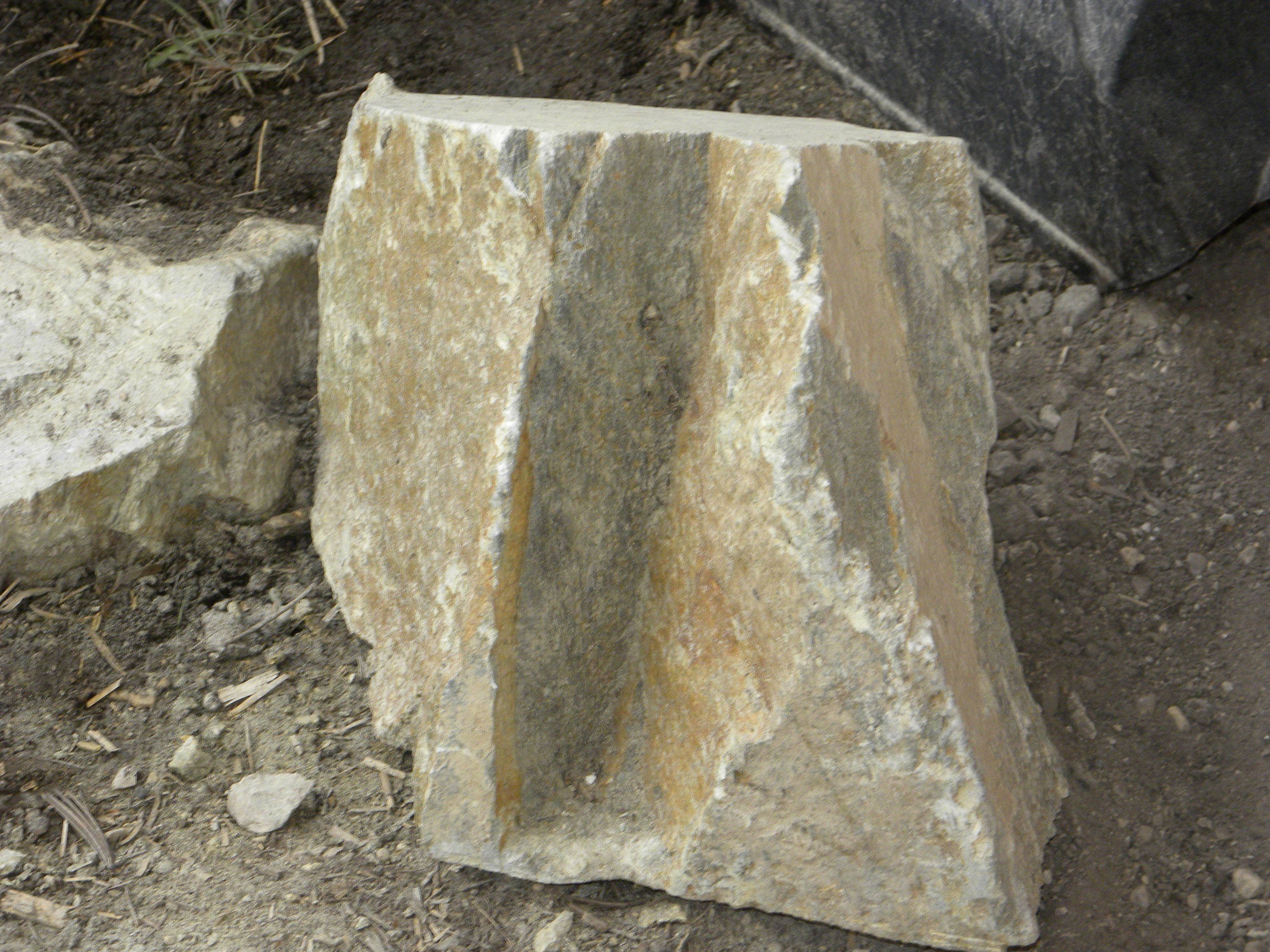
I took a lot of photos of walls. I know something about building stone walls, having designed many and used many masons in my work. These walls were very well-constructed. Of course! They’ve lasted over a thousand years. Some built more meticulous than others. Granaries could be quickly constructed, while housing was finer work. Stones were honed for corners. Although most of the finish has worn off, one can still see in places where plaster was applied so that the end product hid the stone work.

This interesting structure was obviously a kiln

Fingerprints are common to be seen on the plaster and mortar work. If this doesn’t connect you with the people who did this work, nothing will.

Here the plaster is still visible
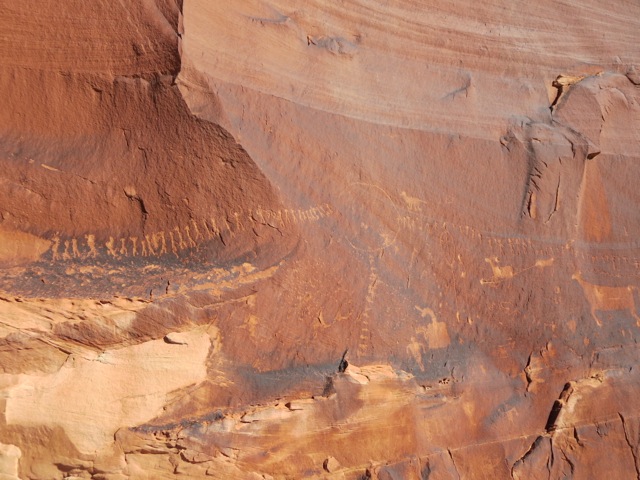
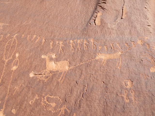
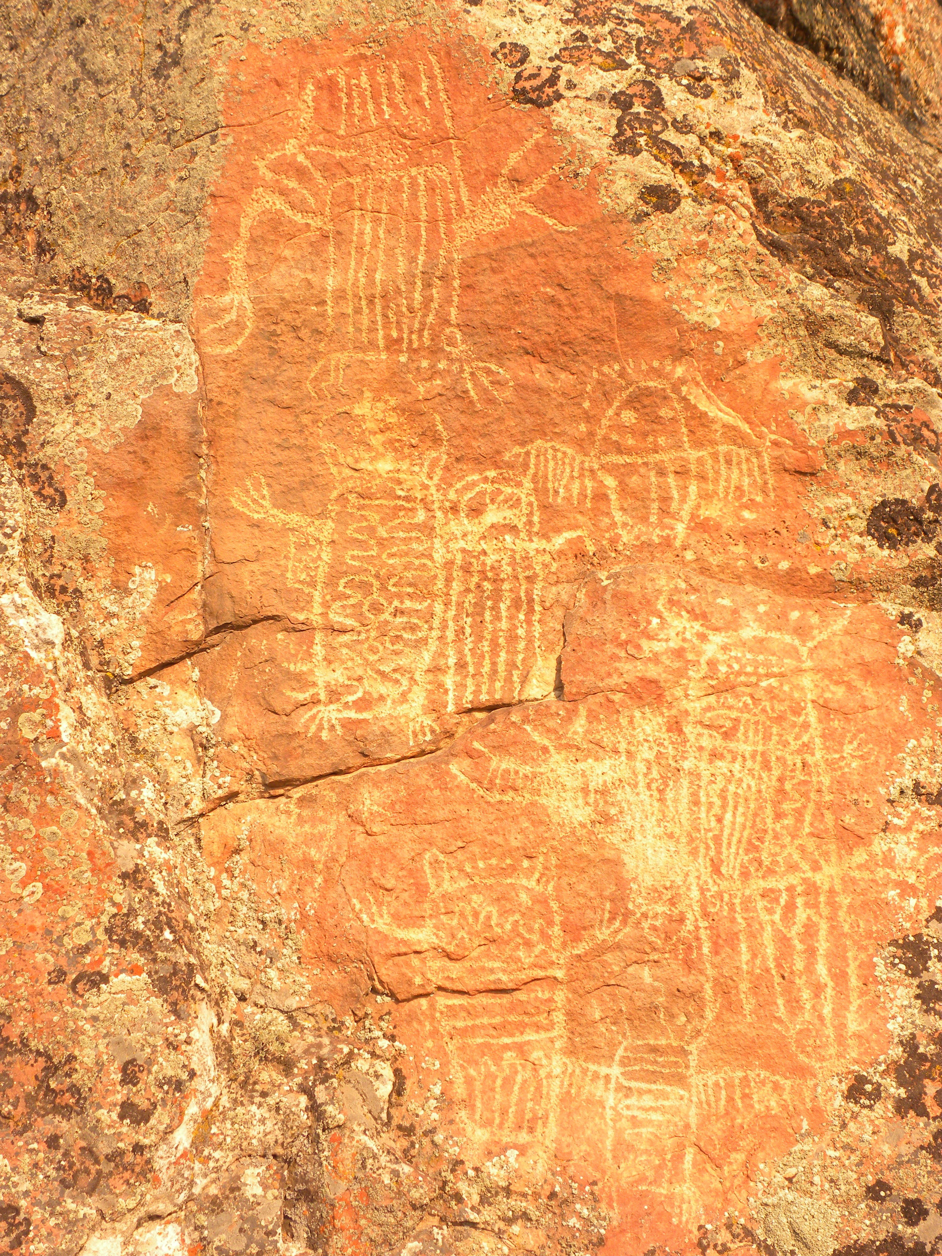
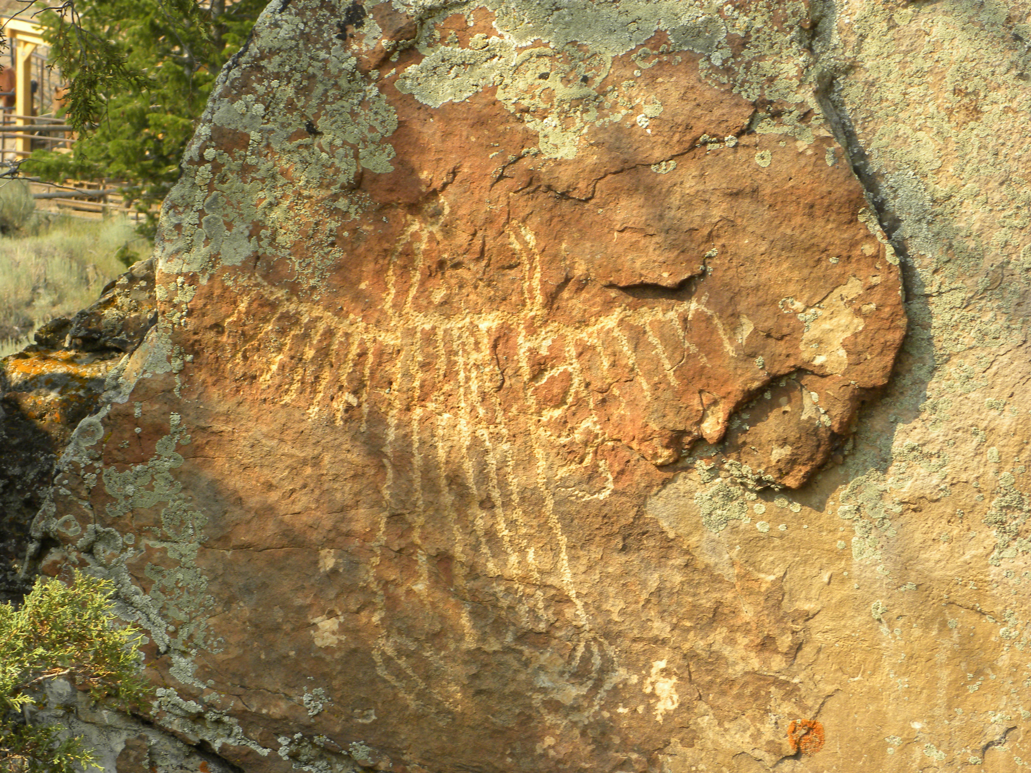
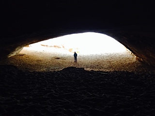
And there’s so much more to Cedar Mesa area–the petroglyphs and pictographs. I took hundreds of photos of writings at many different sites. Seeing so many, I still could not come up with why some sites were picked for writings and others not. There are plenty of perfect patinas for drawings that are empty. Petroglyphs of course were not done in just one period, but a site may contain pictures that span hundreds of years. I found drawings in home dwellings, and more elaborate ones at the very top of a ridge line (on Comb Ridge i.e. the Processional).

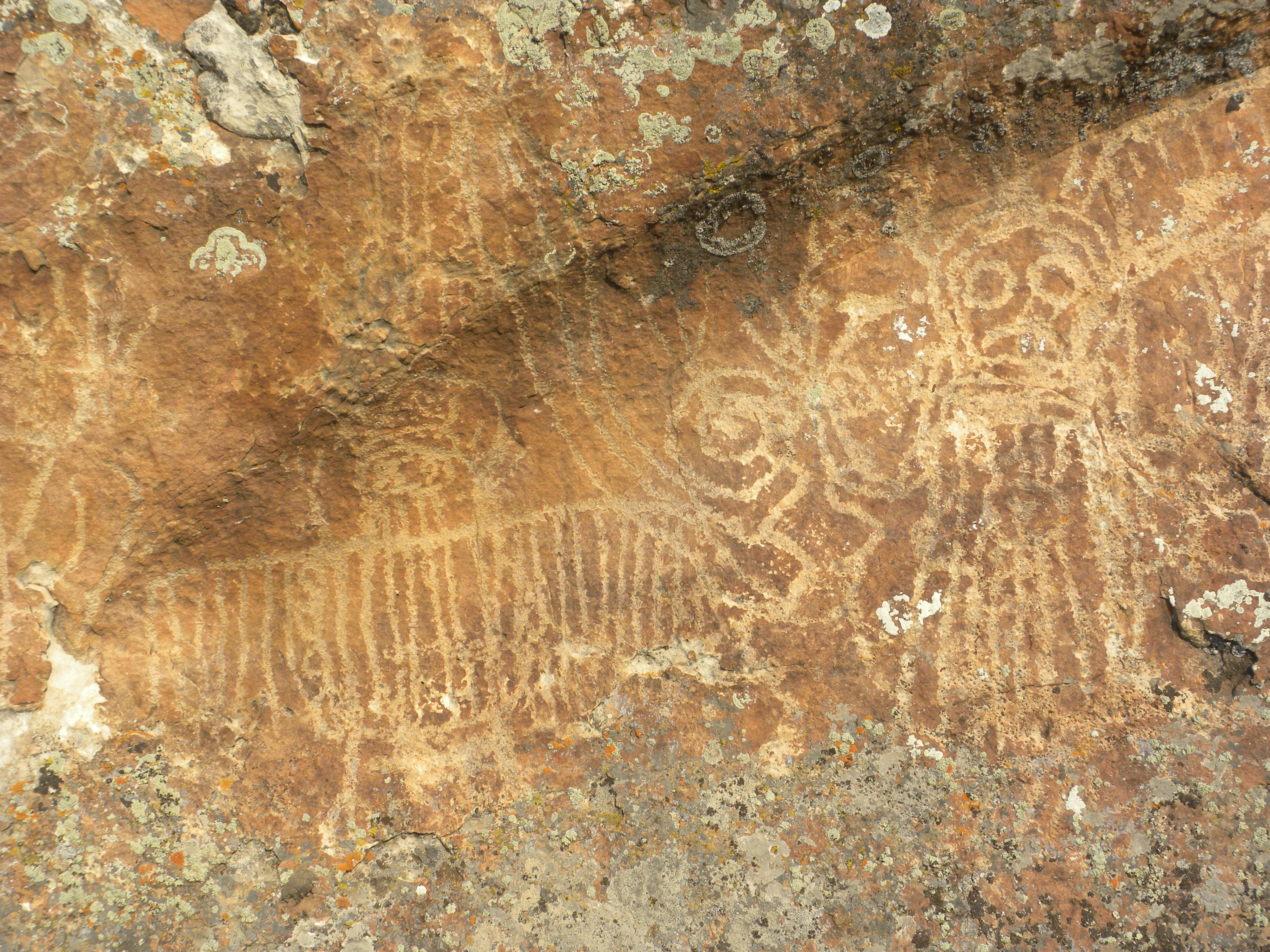
The location of this artwork. This is at the very top of Comb Ridge with a view to the San Juan River miles below

A more macro view of the story

This is a small piece of a very large story called The Processional
Petroglyphs seemed to be at prominent places, like when we hiked down to the San Juan River to a wall with thousands of glyphs. Perhaps this was a crossing place, a signpost for travelers telling them about the game or where to go; maybe it was a vision quest site; or a rock that marked territory. Some of the sites are astronomical indicators and these have been documented. I suspect that glyphs contained all these elements depending upon the site. One thing that becomes obvious quickly: white people write their names and dates; native peoples were telling stories about the land, the landscape and the animals. “As if the Land owned us” says a Ute Indian.
This was my third year of exploration in the Southwest. I highly recommend reading House of Rain by Craig Childs if you are going. It helps to put this great history into perspective. But it wasn’t until I went to Chaco Canyon that the Four Corner Regions all knitted together into an amazing historical tapestry.
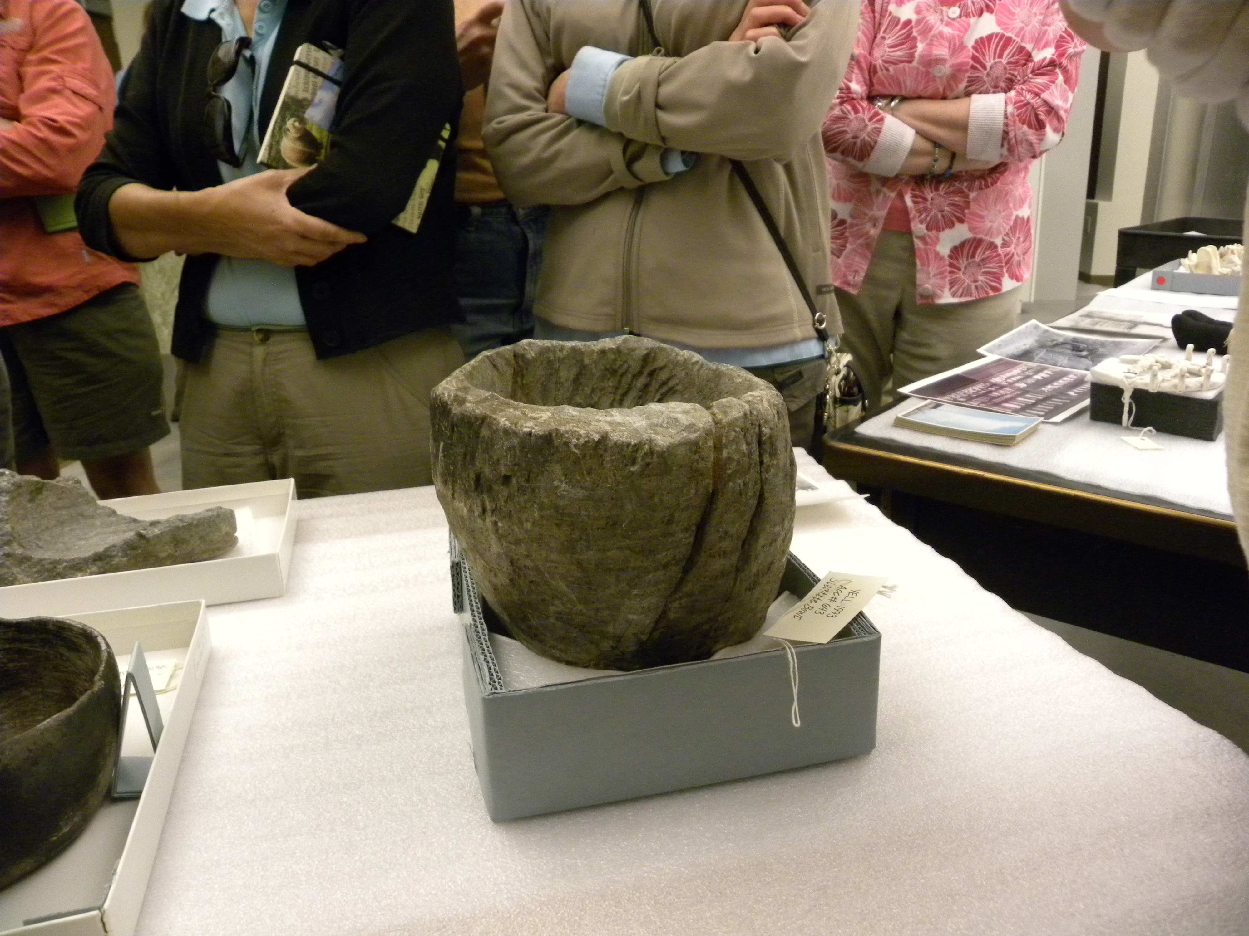
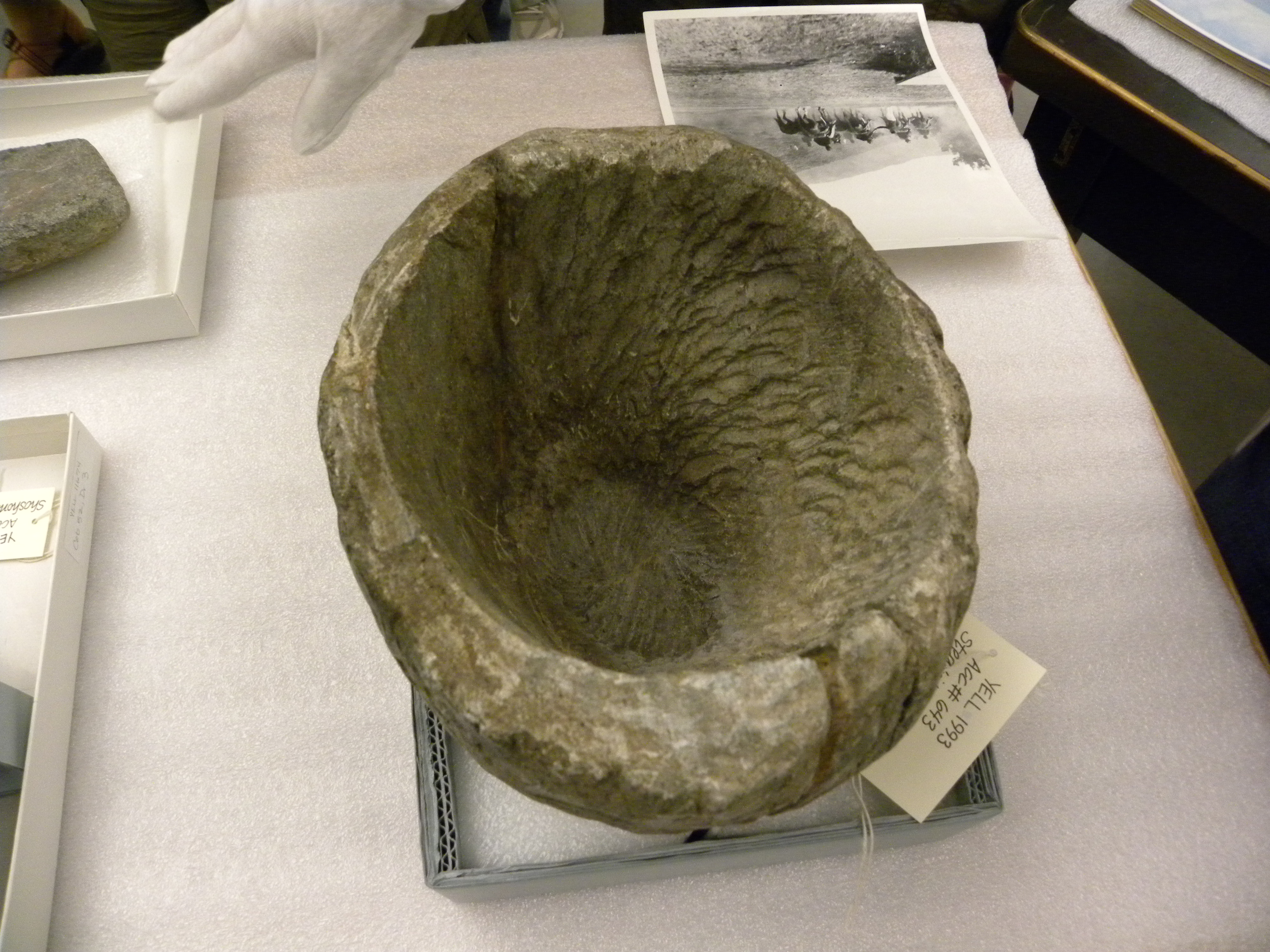
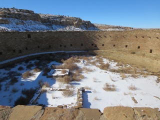
Chaco is our greatest preserved heritage in the United States and so few people have visited it let alone know about it. Frankly, I didn’t either. But once I saw it, I understood so much more about the multi-cultural groups bundled together as the Anazasi than ever before. Chaco was at its height around the 10th-11th century. A massive undertaking of architecture in the middle of the desert, the Chachoans built huge kivas and ‘pueblos’. Pueblo Bonito alone has only had 3 acres excavated and they suspect there are over 6 acres. And there are many many more structures here, all aligned astronomically, all built by the finest builders of the land. Chaco is a ritual landscape, a landscape of spirit lines, where geography and the spirit world combine through astonomy.
Yet so few people actually lived here, less than 6,000 at most. Bins of turquoise, corn from 100’s of different regions, feathers of exotic parrots from the tropics, were found. This was a place of opulence where probably a few priests and caretakers lived. Goods came in, but not out. People today have no words nor concepts for that.
The buildings were not built all at once, but over hundreds of years and changed over time. Great roads over thirty feet wide and so perfectly straight they could have been engineered today fanned out across the landscape. If the road came to a cliff wall, they didn’t go around but build steps straight up to the top. These wide roads, sometimes lined with crushed potsherds, connected to Great Kivas hundreds of miles away. They recently found one from Chaco to Bluff.
Although they don’t know what Chaco really was, if you go there when its quiet, like I did, you can feel a lot. Chaco was a great spiritual center; it was the Heart of the Anazasi, where pilgrimages were made, maybe annually or bi-annually. Maybe just once in a lifetime. And when you went, you brought your gifts of corn. Maybe you stayed a bit, especially if you had spiritual prominence in your smaller community, or did a spirit quest. One can imagine great celebrations and games taking place.

Unique corner window where the light shines through perfectly on the winter solstice

Exquisite walls by master builders at Chaco could be over 4 stories high
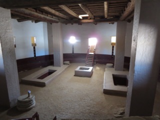
This is a kiva at Aztec Ruins that was reconstructed.

The largest Kiva at Chaco could house hundreds if not a thousand people
Yet Chaco began to decline, and was no longer the center of trade, commerce, and spirituality somewhere around the early 1100’s and the center moved north towards Aztec. And although drought gripped the region in the late 1200’s, that no longer is the sole reason archaeologists suspect for the regions abandonment. To wander around Cedar Mesa, Mesa Verde, or Hovenweep, it becomes obvious these were a frightened people–building in the most defensible and inaccessible places. Hovenweep with its unique towers is the epitome. The towers are placed at the heads of drainages, protecting their precious water. Cannibalism, decapitations, and other extreme violence is evident in these late periods. Cedar Mesa may have held some of the last hold-outs. Why this happened and what was happening, we’ll never know. But more than drought was going on as this was a land of droughts and people had been living here for thousands of years.
Apart from the specifics of its history, my question when I finally visited Chaco was why are we not teaching this in our American History books to our school children? Why does our history, still, after all these years of increased social awareness, begin with Columbus and. at the most, only a nod to native peoples who were here before Europeans? Is it because we are committed to the United States being only an idea: the idea of freedom and democracy? Is that what we have decided binds us, and so that is what we’ve decided we’ll teach?
America is not a concept. It is the Land and the landscape as well, and if we are to be a people connected to Place, then we must learn about Place and how ‘the land owns us’. And although the Anazasi migrated south, and are today’s Hopi, Zuni, and Puebloans by culture and blood, they are still part of the heritage of our America, our Place. And a Great One; one that we can learn from. By excising this history from our studies, we divorce ourselves off from the long history of our Land and its peoples here. I feel that if our youth integrated these ancient histories as their own, we would all come to cherish not only the ruins that remain, but the Land itself and our connection to its preservation.
Filed under: Indigenous cultures | Tagged: Anazasi, Aztec ruins, Cedar Mesa, Chaco Canyon | 2 Comments »