• BOOKS ABOUT WILDLIFE AND HEALTH

  • My latest book available in paperback and eBook formats

  • Available from Amazon paperback or Kindle

  • Updated w/double blind study results. Ebook or paperback

  • New updated edition available NOW!

  • Recent Posts

  • Tracking Footprints

  • Archives

  • Top Posts

  • Pages

The Mystery of Stockade Lake

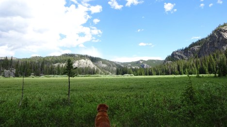
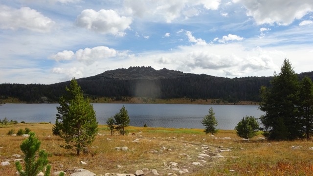
Stockade Lake in the Beartooths is along a National Recreational Loop. At over 10,000 feet, the lake is crystal clear and very beautiful. Last year, a new friend 80 years old, a retired Forest Service employee, offered to show me an old stockade that lay in the trees on the southeast corner of the lake. In the 1980s the Service asked him to investigate, photograph and map the ancient enclosure.

Stockade Lake

Stockade Lake

All the Beartooth maps show a trail to Stockade via Loosekamp Lake. But there is an undocumented use trail that’s only a mere 2 miles directly to south Stockade Lake. We took that route and hopped the outlet.

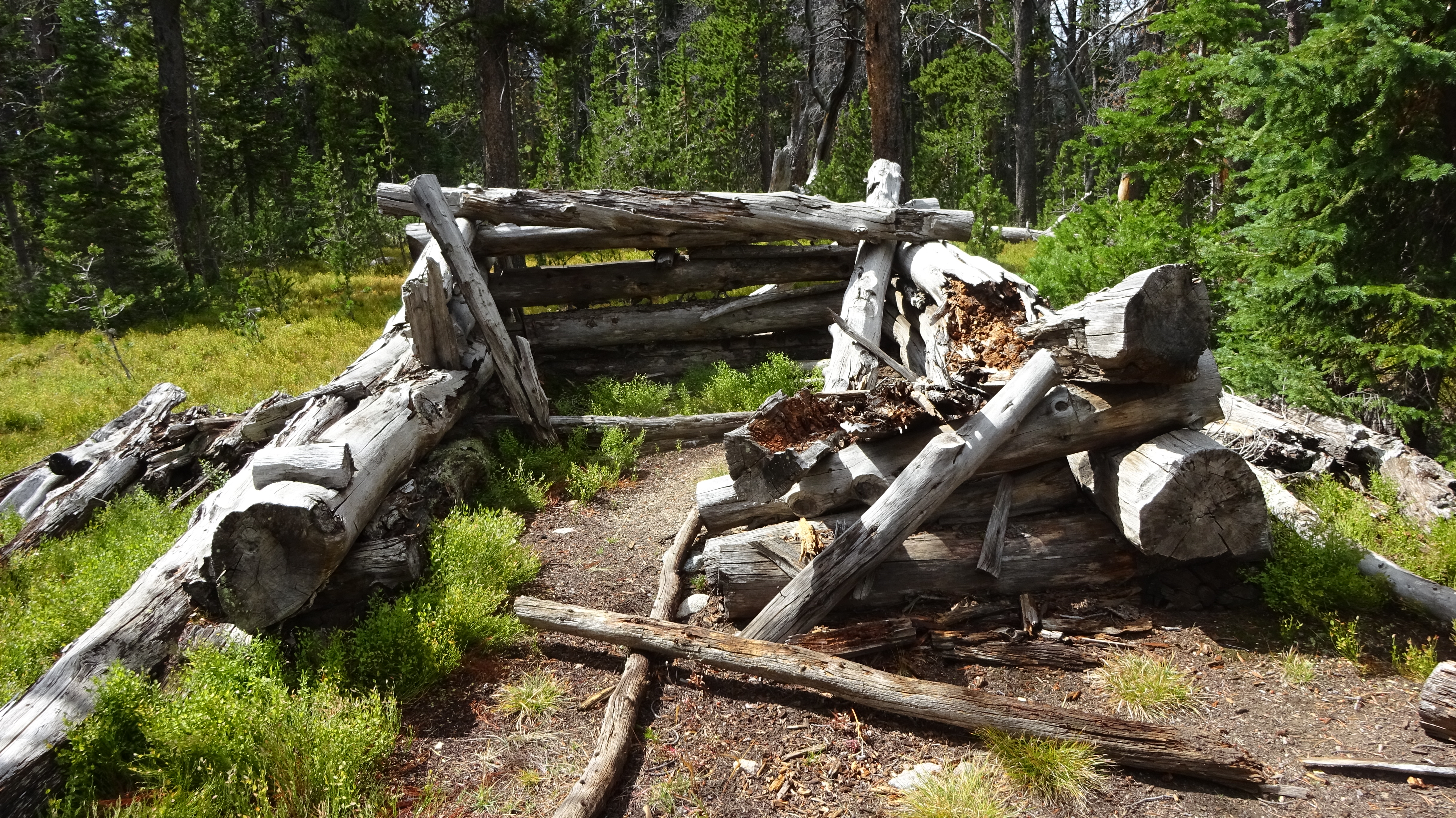
In 1891, Benjamin Greenough, a cowboy from Red Lodge, Montana, stumbled upon this dilapidated wood and stone structure. Surrounded by remnant glacial lakes, the structural remains were assumed to be that of an old stockade. This observation was based on the roughly circular shape of the enclosure, the large, heavy logs used to form the walls, and the ax-cut notches carved into the elevation logs for rifle ports.

Ax cut end

Ax cut end

In 1907 John K. Rollinson, a forest ranger and friend of Greenough, and Harry W. Thurston, the then Supervisor of the Shoshone National Forest, visited the site. His narrative below talks about his discovery of the stockade.

On the way back to my camp I traveled a new route which was previously not accessible, due to old snowbanks. I passed a long narrow lake, and as I had been told of an old log stockade or enclosure there, I soon located it. I do not know what it had been used for. It was quite badly rotted down, but it had been a rectangular affair, about eight feet high, built of a double wall of rather light logs, with an eight- or ten-inch space between the two walls which had been filled in with rocks. Three or four old rock fireplaces had once been in use there. All the ax marks were those of a hand ax or tomahawk, as the cuts showed the tool had had a narrow bit. I concluded that squaws had done the work. On a line running due north and south, through scattered pine timber, all the trees had been peeled halfway around up to a height of about five feet. North of the stockade the blaze was facing north, and south of the enclosure the blaze faced south. Each line ran a distance of about a hundred yards. Some trees had been belted and were therefore dead.

Rollison believed that the structure was likely the remains from a party of white trappers and Indian women who were trapping beaver on the Plateau and had built a defensive structure to protect against a hostile Indian attack. He also felt the structure would date to the late 1860s or earlier based on the level of decay.DSC01354

In 1991, the site was recorded by several archaeologists. They reported seeing five culturally modified trees around the stockade.DSC01352 (1)

In 2009, a group of archaeologists, historians, and members of the Park County Historical Preservation Commission hiked to the stockade and collected tree-ring samples from trees and logs at the site. They located more than a dozen culturally modified trees. Their samples consistently produced two separate dates: 1806-1807 and 1861-1862. After this ‘preliminary’ report, Larry Todd returned the following summer, collected a few more tree samples, and so confirmed the later date, just as Rollinson had predicted.DSC01355

When my Forest Service friend was at the site in the 1980s, he told me the gunsights were visible on the logs, and the log enclosure stood about 3 feet high. But today the stockade is almost fully decayed. You can still see the circular outline and in a few places the enclosure still is two or three logs in height. The ax cuts are visible and young trees are growing in the center area.

Young trees inside Stockade

The stockade sits just a few 100 feet off the main trail, but is very easy to miss. In fact, I encountered two backpackers that had spent the night right near the enclosure and had no idea that it was there.

DSC01350

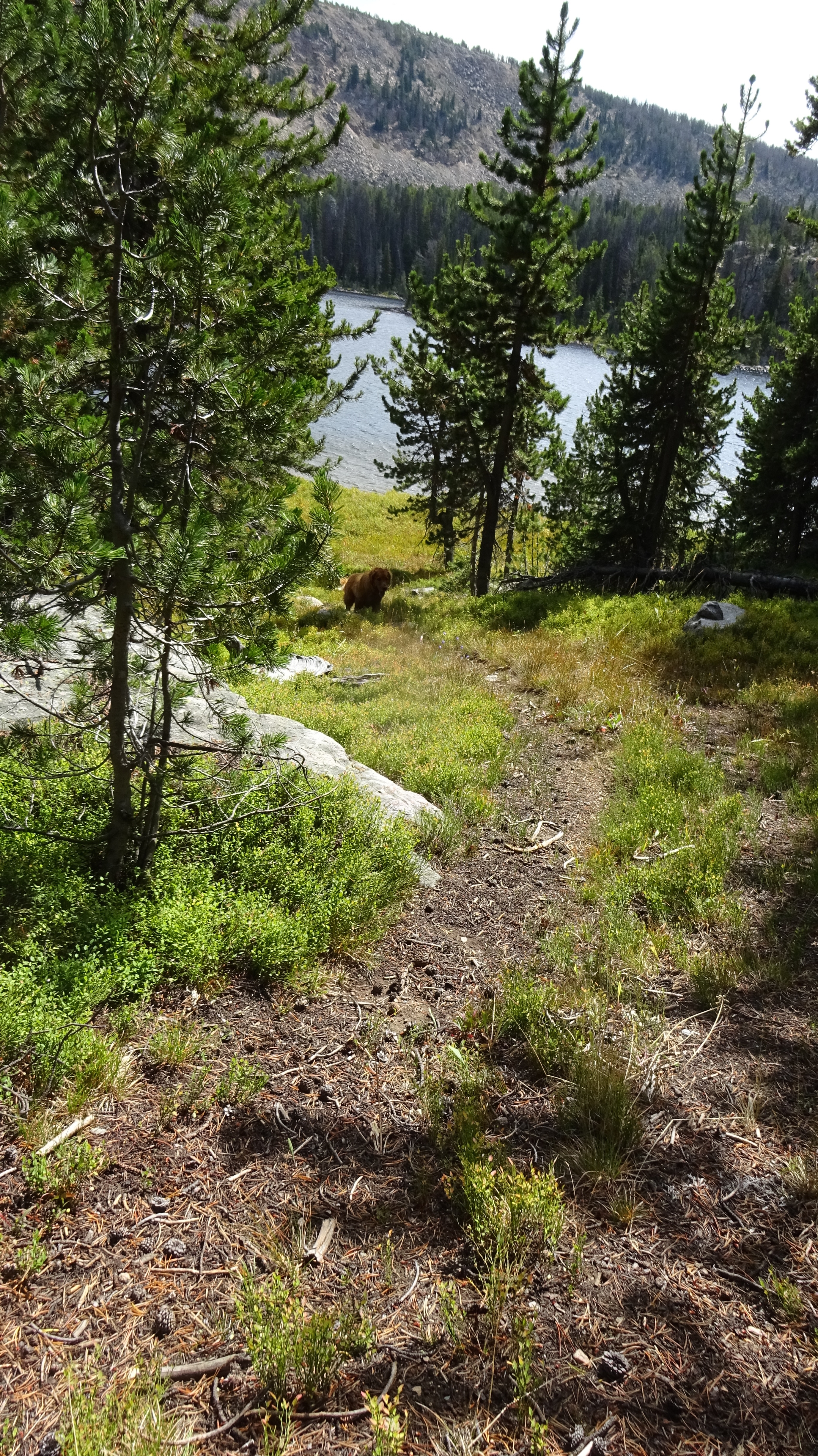
Koda enjoys the shade near the enclosure

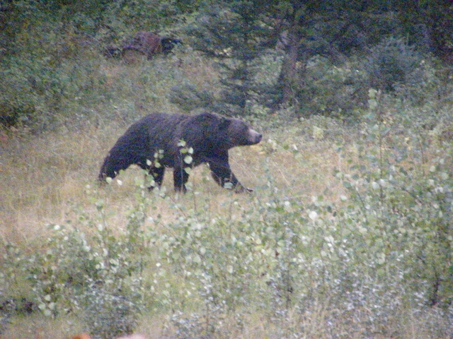
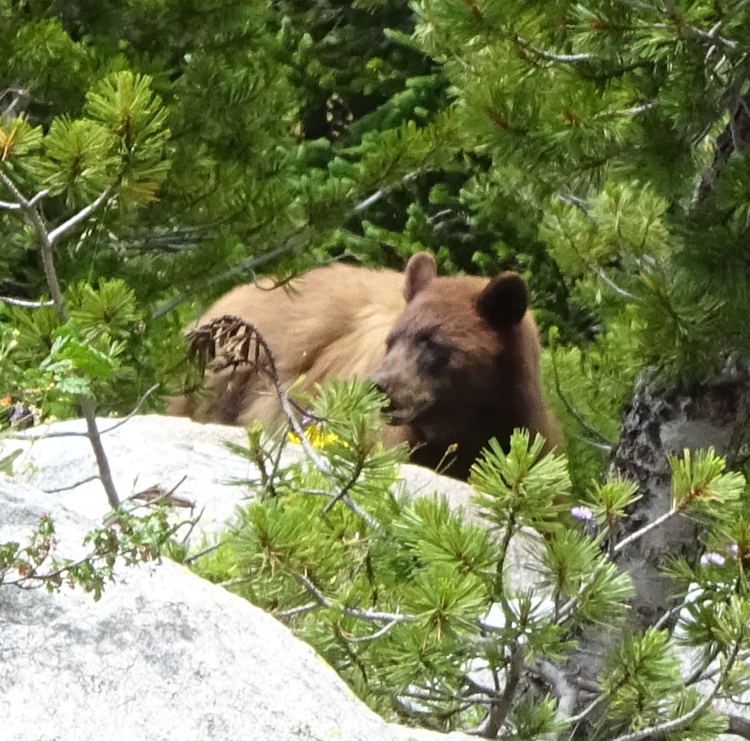
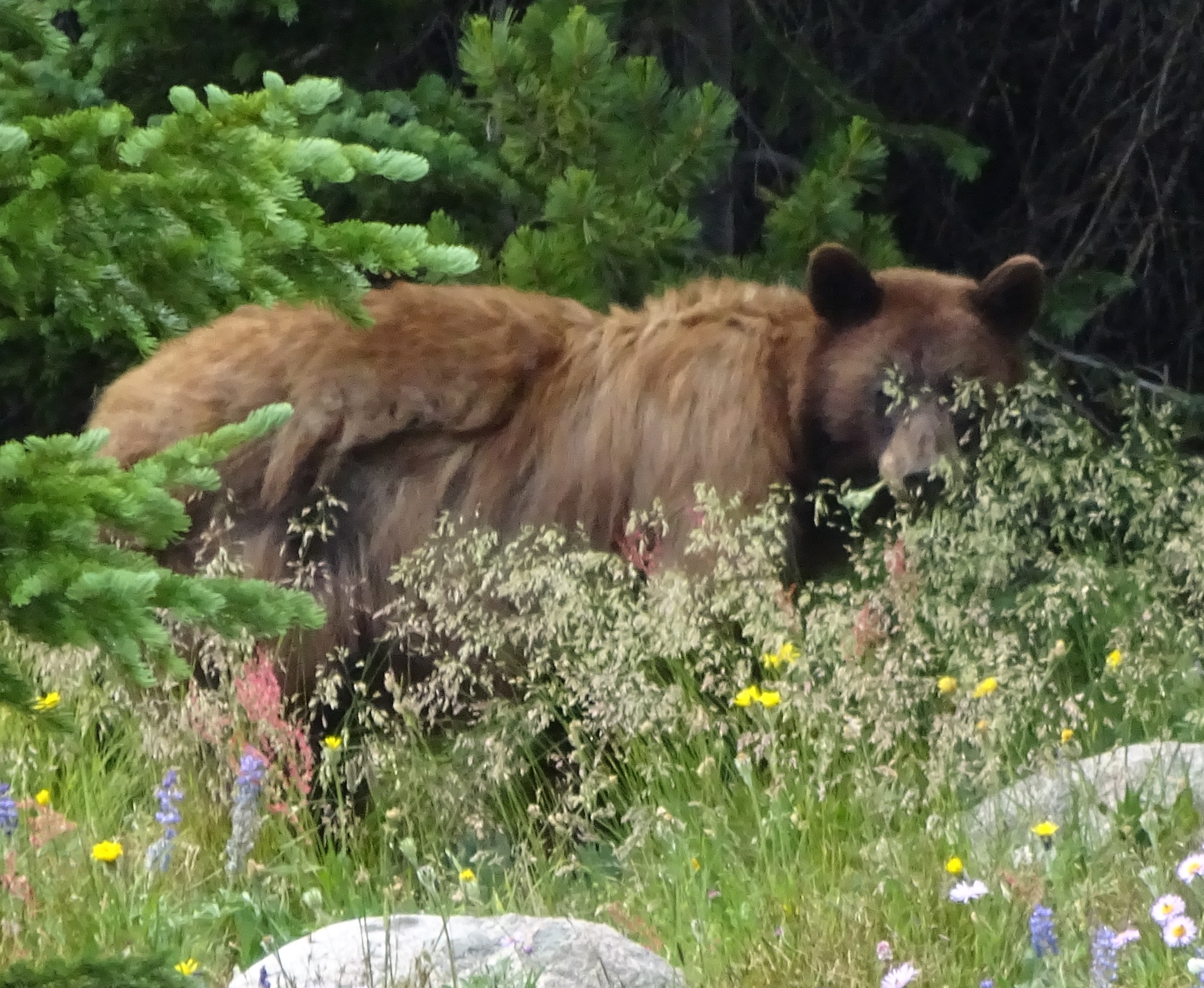
Take a lunch and bear spray (last year I encountered a young grizzly near here at the lake) and enjoy the stockade while you contemplate what happened here 150 years ago.

Trail sign. What does an 'F' mean? Anyone know?

Trail sign. What does an ‘F’ mean? Anyone know?


Muddy Creek, the Beartooths, and Grizzly lore

Muddy Creek is an access trail to Granite Lake in the Beartooth Mountains on the Wyoming side. Although I have done a lot of hiking and backpacking in the Beartooths, I have to admit I haven’t been to Granite Lake, a 228-acre subalpine lake, among the largest in the Absaroka-Beartooth Wilderness. Most people approach the lake through Clay Butte, which is also a trail into Martin Lake Basin and the Beartooth backcountry. Yet since I heard that Granite Lake is a popular horse, fishing, and camping area, I’ve avoided it. Maybe this summer I’ll do the 9 mile roundtrip hike there.

Muddy Creek is one means of entry, and mostly because of its apt name, I haven’t been on that trail either. This being a drier year, I thought I’d try it for a day hike. This is not a trail description entry, but some observations along the stretch I did. But for those interested, the trail is flat, skirting an extensive meadow, until it reaches the mouth of the canyon to Granite Lake. At that point it begins to gently climb into the narrow drainage. I turned around at the incline point and end of the meadows.

This is a beautiful hike that enters the wilderness boundary in about .08 miles from the trailhead and stays in the trees and shade.

DSC01322

Wilderness boundary. Muddy Creek

Muddy Creek used to be a popular trail in the day. You can see old logging cuts throughout, before the area became Wilderness. I’ve read old records where some old-timers considered Ghost Creek (just south of the highway) and east Muddy Creek (north of the highway where the trail is), their private hunting grounds. In fact, I was going around some downed timber when I discovered, about 2 miles up and on the trail, an old trapping snare.

The meadows, in reality, are a wetland full of willows. Fresh moose tracks are everywhere–prime summer habitat for them. But the real surprise is the amount of grizzly bear scat. I’m used to hiking in bear country, but I’ve never seen so much bear evidence as there is on this trail. In the first mile through forest, I’d safely guess that there was a large pile of bear scat every 20 feet and most of it fairly fresh. In fact I saw the freshest pile I’ve ever seen on a hike, one that was still wet and steaming.

DSC01326

Front foot with claw marks

DSC01336 (1)

Bear scat still wet and steaming

I started looking for bear rubs along the trail and found many. Called rub trees, it’s unclear why they use them. Probably as a way of scenting and getting a good back scratch at the same time. Once you’ve seen a rub tree, you’ll know how to look for them. Most I’ve found are on or near human trails. Bears use human trails too. I’ve found several where a trail blaze is in the tree and a bear scratches or rubs that tree. You know who is The Boss then.

Rub trees will have a smooth side to them and will not have lichen there. Look from the side and you will see the bear’s fur. Cattle especially also rub trees so learn to distinguish the fur. Ungulates, especially elk, will sometimes rub and horses as well. But once you’ve seen bear fur, you’ll know it.

Ungulates have hollow hairs. When bent they are stiff and form a sharp bend. Bear’s have finer fur. Try to distinguish which side of a hair is the root. Then look at the opposite end. Most grizzly hairs will have a light tip to them–thus the ‘grizzled’ look. Here is a good photo from USF&W.

40a

It’s more likely that your rub tree fur will look like this:

IMG_1206

Some of the fur I pulled off the tree

View from about halfway up the vast meadowsDSC01325

A few blooming flowers:

DSC01332

New flower for me. Wood Nymph Moneses uniflora

DSC01331

One of my favorites. Thalictrum occidentalis. There are many beautiful Thalictrums in the landscape market.

A real plus for the bears is that I can see this will be a super berry year. Last year all their fall foods were lean and so people were seeing more bears on the edges of the ecosystem. This year my Chokecherries will have a bounty year, and all the flower evidence for Raspberries and Strawberries indicates a boom cycle. In addition, I have not seen any Buffalo berries on plants for many years. But this year the beginning of the fruit is evident.

DSC01334

Shepherdia canadensis. The berries are tiny green now. Red in the fall and I like the taste

And finally, my plea once again for the Great Bear. We are in the midst of a USF&W delisting process for Grizzly Bears which means the states will be managing and hunting them. Walking on the Muddy Creek trail, seeing so much bear sign, is not an indication, as some people have expressed, to be scared and hunt bears so they will avoid people.

Instead, the Great Bear is a mnemonic, a reminder to stay alert and awake. His presence signals I need to hike as a ‘walking meditation’, being fully Present in the moment. Thus, the grizzly is a Spiritual Bear. Let us all honor the Grizzly bear in that manner.

http-%2F%2Fa.amz.mshcdn.com%2Fwp-content%2Fuploads%2F2015%2F11%2Fcurtis4x5-3

Grizzly Bears are sacred to the tribes. We need to all think about them in this manner.


Sparhawk Lake, Beartooths; ATV’s and Grizzly Bears

An old-timer told me about a forest service cabin down at Sparhawk Lake which J.K. Rollinson had stayed in.  “His cowboy boots are still sitting there.”

That I doubted.

J.K. Rollinson is well-known in our little valley.  He was one of the first rangers in Sunlight and wrote a book that included his time here in the early 1900s.  His book, Pony Trails of Wyoming, describes trips to this Beartooth cabin, peppered with stories about dangerous lightening storms in the high country and leading scientists to collect grasshoppers in Grasshopper Glacier.

I wanted to see if the cabin still existed so I drove to the dirt pullout to Sawtooth Lake across from the Island Lake turnout.  The road is excellent for the first 1.5 miles, then turns to a rocky mess.  I parked and walked the final 2.5 miles to Sawtooth Lake.

Sawtooth Lake, Beartooths

Sawtooth Lake, Beartooths

It just so happened that the Northwest Wyoming ORV club had arranged an outing with the Shoshone Forest Service last Thursday to look at a possible loop trail extension from Sawtooth over to the Morrison Jeep Trail.  The Forest Service, in their 20 year plan, has promised three new ATV loop trails. I couldn’t go on that trip and I wanted to see the road conditions for myself, so I included it in my walk-through. The Forest Service and ORVer’s had driven the road (of course).  I feel you can see much more if you are on foot.

The day was lovely and there was no one on the road–not one ATV or hiker. As I approached Sawtooth, I saw a parked car above the lake.  At the lake I heard gunshots. People were target practicing on a beach at the lake.  I hoped they weren’t shooting in my direction.  I headed opposite from them, in the direction of the adjacent Sparhawk Lake.

The road ends at Sawtooth in a large turnout, but I found an illegal ATV use trail that was headed around the lake perimeter towards my destination.  I followed it until the thick trees around Sparhawk prevented the ATVer from going further.

This is an illegal ATV road that follows the northwest boundary of the lake

This is an illegal ATV road that follows the northwest boundary of the lake

Heading through the trees, I quickly came to the cabin, at least what remained of it. And the Forest Service had placed a nice plaque there. No cowboy boots though.

Sparhawk Forest Service Cabin built in 1908

Sparhawk Forest Service Cabin built in 1908

Another view of the cabin

Another view of the cabin

Plaque on rock

Plaque on rock

Close up of plaque

Close up of plaque

I wondered why they didn’t build the cabin at the adjacent, and very large, Sawtooth Lake.  Here’s a photo of pretty little Sparhawk Lake.

Sparhawk Lake

Sparhawk Lake

I made my way back to Sawtooth and began the return walk.  Less than 1/4 mile from the lake, by a small meadow surrounded by trees, I heard a very strange sound.  A deep and sonorous honking was repeatedly coming from the forest. I stopped, hoping to glimpse what was making these strange noises.  Suddenly a big grizzly was running along the forest edge followed by a cub of the year. Seconds later another cub, and after a minute another cub!  Something had spooked them to run down towards the lake.  I was far enough away, with the wind in my face, that I wasn’t worried. Here’s a link to a black bear cub making a similar noise. Hearing this, I assumed the sound I heard was from the last little cub who became separated from mom.

This area where the ORV club wants a loop trail is in the PCA (Protected Conservation Area for grizzly bears) and with my sighting, it’s obviously a critical area for these bears. What’s proven is that traffic, especially these loud machines, is very disruptive for bears. A loop trail will bring more traffic here. As of now, people are camping right next to the lake creating fire rings. There are no bear boxes to store food in, and car/ATV campers invariably bring more trash in and tend to not pack it all out (or throw it in their campfire rings).

Young grizzly in the meadows by my house

Young grizzly in the meadows by my house

This year we’ve already had several bears destroyed because they were food adapted. There have been stories of restaurants next to, or even in the Park, dumping their grease outside. Bears that find any food rewards graduate to problem bears which become dead bears.

I’m not necessarily against this area looping with the Morrison Jeep road.  By Sawtooth Lake, it’s only less than 1/4 mile to loop the two roads.  But as ATV’s become more prevalent, their riders need to take responsibility for self-policing illegal off-shoots and keeping a clean camp.  The intense noise factor needs to be considered.  In addition, taking your vehicle into the back country and shooting off guns should be made illegal unless it’s hunting season.

ReWilding the Beartooths

It’s happening.  Grizzlies are re-inhabiting the Beartooth Mountains.

grizzly warning sign in the greater yellowstone area

Grizzly warning sign in the lower elevations. Now bears are returning to the high elevation Beartooths

In the last few years, Grizzly activity has increased along the flanks of the Beartooth Front, the southeastern base that nestles the community of Red Lodge and the long north and eastern drainages where berries and other fall foods are abundant. Red Lodge is now getting its share of grizzly bears. But still there were few reports of bear activity in the high alpine forests.

Certainly bears have used the lower drainages on the west side of the Beartooths like Crazy Creek,  Soda Butte, or Lily Lake.  These are low elevations that provided a corridor through Cooke City into and out of the Park.

Years ago I heard of a sow who lost her young cub in the spring to an automobile.  She bawled for a week around the Clay Butte/Beartooth Lake area, looking for her cub.  Yet although I’ve backpacked frequently, and spend a lot of time in the summers day-hiking the western Wyoming side every year, I’ve never seen any bear sign–tracks or scat.

The Beartooths still offer bears great habitat.  The excessive moisture brings a lot of plant food opportunities in the way of grasses, forbs and roots.  And they still have healthy stands of White Bark pines.  White Bark pines in the GYE are 90% dead.

Avalanche Peak, Yellowstone.  Dead whitebark pines

Avalanche Peak, Yellowstone. Dead whitebark pines

The exception to that rule are the Wind River Mountains and the Beartooths.

White Bark pines in the Winds.  Healthy stands

White Bark pines in the Winds. Healthy stands

And those Marmots have traditionally been a favorite protein for bears.

Marmot

Marmot

So when I began my hike today from Hauser Lake down to Stockade Lake, I figured that there were no bears around these parts–especially so high.

Losekamp Lake (around 9600′) sits at the base of Tibbs Butte (10,676′).  Grizzly bear watchers will tell you that these bears mysteriously disappear around the 4th of July.  For years no one knew where they went, until a pilot flying over high talus slopes in the mid-80s saw bears congregating there.  These bears were taking advantage of Army Cutworm moths who feed on alpine plants and summer here.  My understanding is that the Beartooths, although high and abundant in these talus slopes, do not have moth sites, although the Wind Rivers does.

Losekamp and Stockade lakes are rarely visited, being on the less popular southern side of the highway.  I was alone on my walk.  Koda and I made our way down to Stockade Lake, where I tooled around for a bit looking for an elusive Sheep Eater trap I was told was once there.

Stockade at stockade lake

Stockade at stockade lake

Stockade Lake

Stockade Lake, Beartooths, WY

With little wind and mosquitos too thick for a lunch break, we headed back towards Losekamp lake.  Koda a bit ahead, went off the trail about 10′ to smell something behind a boulder.  All of a sudden he growled–a sure sign of an animal he got scared of–and I looked up to see a sleepy bear rise from the boulder.  I quickly called Koda back, and grabbed my bear spray.  We stopped for a moment to access.  The bear, surprised and probably a bit scared himself, immediately began eating, displacing his fear to food.  He seemed sleepy and not about to run away, nor be aggressive.  He pondered us.

Young bear

Young bear

Grizzly bear

A young grizzly, probably just kicked out this year, I did wonder if his mama was around.  Lucky for us she was no where to be seen.  I gave the bear a big berth, going off and around the trail, while talking to him gently, apologizing for waking him up.

Most grizzly encounters end this way, with the bear usually running off. A few weeks ago around my area, Koda alerted me to a grizzly that was also sleeping by the trail, awakened by our presence.  Koda kept by my side, and the griz, about 200′ away, pondered us for a moment, then ran off.  Dogs will alert you and keep you safe if they are well-mannered and under good voice control.  A dog that runs all over the hills and is not very responsive poses a grave danger for a person, as the dog might bring the bear back to you in his fear, with the grizzly following.   The best book to read for safety with grizzlies is Hiking with Grizzlies by Tim Rubbert, or watch online The Edge of Eden: Living with Grizzlies with Charlie Russell and observe Charlie’s body posture when dealing with bears and using bear spray.  Stay away from those books about Grizzly attacks.  It’s like reading a book about fatal car accidents instead of actually learning how to drive safely.

Robin egg, hatched

Robin egg, hatched

Upon returning to the car at the trailhead, I stopped at the Top of the World Store to deliver some of my Wild Excellence books.  I told Kristi Milam, the owner, about my bear experience and she told me there’s been a lot more sightings this year than ever before.

One other note on the Beartooths:  it’s becoming an excellent place to possibly see, or hear, wolves.  I’ve been seeing tracks of the Beartooth pack around this same area for weeks, as well as Clay Butte and lower elevations like Crazy Creek drainage.  Wolves were spotted up at Top Lake just weeks ago in the meadows. Elephant's head

With Grizzly Bears and wolves returning to the Beartooths, they are finally re-wilding.  Carry bear spray and be safe.

The GLORIA project in the Beartooth Mountains

I was in the Pryor Mountains last month on a BioBlitz.  What’s a Bioblitz you might ask?  It’s an appropriate name, because in the span of about 24 hours people group up and find as many species as they can.  I of course signed up for the botany group, but other areas included bats, invertebrates, birds, or mammals. There was even a ‘spider’ category.  In that 24 hours, we hiked and drove from desert to alpine environment, documenting every plant we could find.  Those we were unable to identify in the field, we brought back to camp to identify where a nice shade tent with tables, microscopes, and plant books was provided.  It was a lot of work and a lot of fun.

At the BioBlitz I met Professor Lyman who is the botany teacher at Rocky Mountain College in Billings. She had other projects going which were near the Sunlight area that I offered to help on.  First we met up on Bald Ridge where she had a camera on Shoshonea pulvinata, a rare plant that appears on only a very few sites around the Cody area.  She wanted to discover what the pollinators were for this plant.  I offered to check the camera, but the plant had already finished blooming.  We hiked the ridge and discovered several pockets of this plant, mostly on cliff edges where the scree is thick and the drainage is perfect.

Rare plant at Bald ridge

Shoshonea pulvinata green plant not blooming

Where Shoshonea grows on Bald Ridge

Her next project began last week.  The GLORIA project was to be set up on four high peaks in the Beartooth Mountains.  This is a worldwide project that’s been going on for about 10 years and started over in Europe.  The idea is to monitor climate change by detecting changes in the plant life at these mountain summits.  The set-up is very detailed, pain-staking, and specific.  The peaks must be 50 meters minimum distance from each other and at least 50 meters elevational change from each other.  A formula is used to measure off distance down the slope at 5 and 10 meters North, South, East, and West; then a grid is installed at each bearing.  At the grid-mark, plants are counted and identified.  A heat sensor is installed which will record temperature changes.  Every five years the same exact area is recounted as to the plant material and the percentages of species change.

View from one of the GLORIA summits

The project set-up was a lot of work but very interesting.  One day I helped carry supplies in to the summit and measure off the  grid.

Marking the grid for photographs

Another day after completing a second grid area, we hiked the afternoon looking for another appropriate summit.  The top of the Beartooths is a beautiful location to spend the day, especially with the heat down lower.  One afternoon we got run off the mountain by fast moving thunderstorms.  The highest bare summit is no place to be in a lightening storm.

Counting plant material within the grid

One day in surveying the summit, which is treeless and fairly shrubless, we actually found a bird’s nest with chicks in it.  I would guess there are few predators up there.

Bird nest on summit with chicks

A possible summit

The Beartooths contain some of the oldest rock in the world.  Professor Lyman’s husband is a geologist and he pointed out some pure quartz veins to me.  Here’s a giant that I wished I could haul home (the rock not the dog!).

Quartz on the summit

Domestic sheep were run on these mountains until the early 2000’s.  Domestic sheep, when they intermingle with Big Horn Sheep, cause our natives to develop diseases like pneumonia  to which the native sheep have no resistance.  These old sheep allotments have been retired–a good thing.  But I suspect these summit cairns are left-overs from sheep herders.

Sheep herder cairn on a summit with quartz

On the way home one evening, right near the Top of the World store, a fox was in the road chowing down on a road-killed ground squirrel.  Oddly, he didn’t move for the traffic and I got some good photos.  Even when this motorcyclist was right bye him, he continued to eat for a long time.  Fox are considered predators in Wyoming and can be shot on sight at any time of the year.  Good thing none of these motorists were on that kind of a mission, just a sightseeing mission.

Close to Open–Yellowstone Park

The NE entrance will be open on May 11th, they say.  We’re always the last for the Park to plow and I’m not sure why.  Its only a nine mile stretch and a heck of a lot easier to plow than the east entrance over Sylvan Pass.  Must be politics and economics driving the decisions. I had to see for myself today the snow pack left.  Besides, I was hoping to purchase a fishing license at the Crandall store.  So a friend and I took a ride.

Before we got too far, the Switchback Ranch on the other side of the Clark’s Fork was flying all their summer supplies over.  Unbelievably, there really is no access to this ranch from Clark, which is on that side of the canyon.  If you drive to the desert and up to the mouth of the Clark’s Fork Canyon, there’s a primitive (and I mean PRIMITIVE) jeep road that goes along the river’s edge.  At the 4 mile mark, the road climbs the side of the canyon in switchbacks–thus the name of the ranch.  I’ve been at the base of the climb, but not up it.  I understand that even in an ATV you do 3-point turns at every corner, and its’ a hairy scary ride.  The road itself along the river is more like driving in a dry riverbed, rough for even an ATV.

Look at the green area. That's the ranch across the canyon

The previous owner was connected with Ford Motor Co., a man named Bugas.  Bugas owned a lot of property in my basin as well.  The current owner is David Leuschen, a Wall Street Mogul.  Oddly enough when I first purchased my property I had a client in California whose husband is a trader.  While I was designing and installing their garden, he was over here on a retreat at the Switchback.

Because of the treacherous and arduous and impossible access to the Ranch, all the major supplies are flown over.  Their base is a forest service knoll by the highway, directly across from the Ranch.  The supplies are attached to a helicopter and flown over the Clark’s Fork Canyon, a thousand feet below.

Returning for a new load

All the gas and diesel fuel for the year are carried over in several passes

Catching the free line and ready to attach. A flatbed worth of seed

1500 pounds of seed in that sack.

Off it goes to the Ranch. The whole process there and back just takes about five minutes.

It’s a beautiful place but no matter how much money I had, I wouldn’t want my supplies and friends flown in.  The old Wright ranch on the Bench used to have a zip line across the creek and that was how you’d get over there.  Now there’s a bridge, but that’s up the road near Crandall.

For all of you thinking of trying to get into the Park early, I’d say not this week.  We got pretty far, but the snow was still over the road at around Lolo Pass.  Up on the Beartooth, you can drive quite a ways, but not as far as the lake yet.  The run-off though is beginning.  This is Beartooth creek taken from the road.

Spring runoff in the Beartooth is beginning

And a moose grazing happily undisturbed

Beartooth Cow Moose amidst last years logged area in Aspens

And home in my front yard

Buck with nubby antlers in front yard

Unfortunately, the Crandall store didn’t have their fishing licenses in yet.  Guess I’ll just have to go for another ride next week.

Reefs, Bears, and the Beartooths

On of the unusual features of this area are the ‘reefs’, long cliffs exposed in the mountainsides.  There’s a beautiful area nearby that I’ve been exploring this summer called Reef Creek.

Reefs

Reefs

A forest service road winds precariously up to the top of the reef, where you discover you’re now driving on a totally flattened surface.  You can walk to the edge of the cliffs and its a sheer drop down.  Parts of the dirt road even look like they’ve been paved.  That’s because you’re on pure rock in areas.

I’ve walked the entire road in pieces including the uphill.  I finally discovered the road’s end (of course, many people have 4-wheeled to the end without walking…but to walk it is to know it) at a small creek, aptly named Reef Creek.  Beyond is a well maintained trail that loops over a pass and back into my valley.

I hiked a few miles up the trail the other day.  The trail winds in high country, although fairly flat, and is home to abundant stands of White Bark Pines.  Alarmingly, most of the mature trees were dead from beetle kill.

White bark pines dead on Reef Creek

White bark pines dead on Reef Creek

I had seen old signs of grizzly scat with pine nuts in it.  I thought of the Great Bear and how difficult it must be to find viable cones.  Bears probably have their favorite haunts.  I imagined them returning here, only to find the cupboards bare.

I climbed higher and finally discovered a few niches of live mature stands.  There are young white barks alive among the dead, but they won’t be producing for 30 or 40 years.

I also encountered the newest addition to my tree list, Abies lasiocarpa or the Sub-Alpine fir.  Its beautiful smooth bark and christmas tree look make it easy to identify.  Abies, or true firs, always have their cones standing upright.  Picea, or spruce, have their cones pendulous (P in the Picea can stand for pendulous).  The botany lumpers and splitters seem to be warring again over exactly if there is a different species named A. bifolia that is almost a look-alike.  But for now, lasiocarpa is good enough for me.

Abies lasiocarpa

Abies lasiocarpa

In contrast to this scene of dying trees, I took a ride up to the Beartooths just two days ago.  I wanted to see this gorgeous area before the road closed.  I was not disappointed.  The mosquitos were gone.  And better than that, I spent the afternoon hiking at Island Lake and didn’t see one person.  The White Barks I encountered around the lakes there appeared healthy although I have never seen much bear sign in the higher elevations of the Beartooths. One of the WG&F bear specialists told me that there aren’t many moth sites they know of there so it’s not a frequented area by many Grizzlies.

The afternoon was warm and I couldn’t have asked for a more perfect day.Beartooth in fall

Beartooths

Fish in the beartooths

Fish in the beartooths

Ahh, not a soul around

Ahh, not a soul around