• BOOKS ABOUT WILDLIFE AND HEALTH

  • My latest book available in paperback and eBook formats

  • Available from Amazon paperback or Kindle

  • Updated w/double blind study results. Ebook or paperback

  • New updated edition available NOW!

  • Recent Posts

  • Tracking Footprints

  • Archives

  • Top Posts

  • Pages

The Mystery of Stockade Lake

Stockade Lake in the Beartooths is along a National Recreational Loop. At over 10,000 feet, the lake is crystal clear and very beautiful. Last year, a new friend 80 years old, a retired Forest Service employee, offered to show me an old stockade that lay in the trees on the southeast corner of the lake. In the 1980s the Service asked him to investigate, photograph and map the ancient enclosure.

Stockade Lake

Stockade Lake

All the Beartooth maps show a trail to Stockade via Loosekamp Lake. But there is an undocumented use trail that’s only a mere 2 miles directly to south Stockade Lake. We took that route and hopped the outlet.

In 1891, Benjamin Greenough, a cowboy from Red Lodge, Montana, stumbled upon this dilapidated wood and stone structure. Surrounded by remnant glacial lakes, the structural remains were assumed to be that of an old stockade. This observation was based on the roughly circular shape of the enclosure, the large, heavy logs used to form the walls, and the ax-cut notches carved into the elevation logs for rifle ports.

Ax cut end

Ax cut end

In 1907 John K. Rollinson, a forest ranger and friend of Greenough, and Harry W. Thurston, the then Supervisor of the Shoshone National Forest, visited the site. His narrative below talks about his discovery of the stockade.

On the way back to my camp I traveled a new route which was previously not accessible, due to old snowbanks. I passed a long narrow lake, and as I had been told of an old log stockade or enclosure there, I soon located it. I do not know what it had been used for. It was quite badly rotted down, but it had been a rectangular affair, about eight feet high, built of a double wall of rather light logs, with an eight- or ten-inch space between the two walls which had been filled in with rocks. Three or four old rock fireplaces had once been in use there. All the ax marks were those of a hand ax or tomahawk, as the cuts showed the tool had had a narrow bit. I concluded that squaws had done the work. On a line running due north and south, through scattered pine timber, all the trees had been peeled halfway around up to a height of about five feet. North of the stockade the blaze was facing north, and south of the enclosure the blaze faced south. Each line ran a distance of about a hundred yards. Some trees had been belted and were therefore dead.

Rollison believed that the structure was likely the remains from a party of white trappers and Indian women who were trapping beaver on the Plateau and had built a defensive structure to protect against a hostile Indian attack. He also felt the structure would date to the late 1860s or earlier based on the level of decay.DSC01354

In 1991, the site was recorded by several archaeologists. They reported seeing five culturally modified trees around the stockade.DSC01352 (1)

In 2009, a group of archaeologists, historians, and members of the Park County Historical Preservation Commission hiked to the stockade and collected tree-ring samples from trees and logs at the site. They located more than a dozen culturally modified trees. Their samples consistently produced two separate dates: 1806-1807 and 1861-1862. After this ‘preliminary’ report, Larry Todd returned the following summer, collected a few more tree samples, and so confirmed the later date, just as Rollinson had predicted.DSC01355

When my Forest Service friend was at the site in the 1980s, he told me the gunsights were visible on the logs, and the log enclosure stood about 3 feet high. But today the stockade is almost fully decayed. You can still see the circular outline and in a few places the enclosure still is two or three logs in height. The ax cuts are visible and young trees are growing in the center area.

Young trees inside Stockade

The stockade sits just a few 100 feet off the main trail, but is very easy to miss. In fact, I encountered two backpackers that had spent the night right near the enclosure and had no idea that it was there.

DSC01350

Koda enjoys the shade near the enclosure

Take a lunch and bear spray (last year I encountered a young grizzly near here at the lake) and enjoy the stockade while you contemplate what happened here 150 years ago.

Trail sign. What does an 'F' mean? Anyone know?

Trail sign. What does an ‘F’ mean? Anyone know?


Muddy Creek, the Beartooths, and Grizzly lore

Muddy Creek is an access trail to Granite Lake in the Beartooth Mountains on the Wyoming side. Although I have done a lot of hiking and backpacking in the Beartooths, I have to admit I haven’t been to Granite Lake, a 228-acre subalpine lake, among the largest in the Absaroka-Beartooth Wilderness. Most people approach the lake through Clay Butte, which is also a trail into Martin Lake Basin and the Beartooth backcountry. Yet since I heard that Granite Lake is a popular horse, fishing, and camping area, I’ve avoided it. Maybe this summer I’ll do the 9 mile roundtrip hike there.

Muddy Creek is one means of entry, and mostly because of its apt name, I haven’t been on that trail either. This being a drier year, I thought I’d try it for a day hike. This is not a trail description entry, but some observations along the stretch I did. But for those interested, the trail is flat, skirting an extensive meadow, until it reaches the mouth of the canyon to Granite Lake. At that point it begins to gently climb into the narrow drainage. I turned around at the incline point and end of the meadows.

This is a beautiful hike that enters the wilderness boundary in about .08 miles from the trailhead and stays in the trees and shade.

DSC01322

Wilderness boundary. Muddy Creek

Muddy Creek used to be a popular trail in the day. You can see old logging cuts throughout, before the area became Wilderness. I’ve read old records where some old-timers considered Ghost Creek (just south of the highway) and east Muddy Creek (north of the highway where the trail is), their private hunting grounds. In fact, I was going around some downed timber when I discovered, about 2 miles up and on the trail, an old trapping snare.

The meadows, in reality, are a wetland full of willows. Fresh moose tracks are everywhere–prime summer habitat for them. But the real surprise is the amount of grizzly bear scat. I’m used to hiking in bear country, but I’ve never seen so much bear evidence as there is on this trail. In the first mile through forest, I’d safely guess that there was a large pile of bear scat every 20 feet and most of it fairly fresh. In fact I saw the freshest pile I’ve ever seen on a hike, one that was still wet and steaming.

DSC01326

Front foot with claw marks

DSC01336 (1)

Bear scat still wet and steaming

I started looking for bear rubs along the trail and found many. Called rub trees, it’s unclear why they use them. Probably as a way of scenting and getting a good back scratch at the same time. Once you’ve seen a rub tree, you’ll know how to look for them. Most I’ve found are on or near human trails. Bears use human trails too. I’ve found several where a trail blaze is in the tree and a bear scratches or rubs that tree. You know who is The Boss then.

Rub trees will have a smooth side to them and will not have lichen there. Look from the side and you will see the bear’s fur. Cattle especially also rub trees so learn to distinguish the fur. Ungulates, especially elk, will sometimes rub and horses as well. But once you’ve seen bear fur, you’ll know it.

Ungulates have hollow hairs. When bent they are stiff and form a sharp bend. Bear’s have finer fur. Try to distinguish which side of a hair is the root. Then look at the opposite end. Most grizzly hairs will have a light tip to them–thus the ‘grizzled’ look. Here is a good photo from USF&W.

40a

It’s more likely that your rub tree fur will look like this:

IMG_1206

Some of the fur I pulled off the tree

View from about halfway up the vast meadowsDSC01325

A few blooming flowers:

DSC01332

New flower for me. Wood Nymph Moneses uniflora

DSC01331

One of my favorites. Thalictrum occidentalis. There are many beautiful Thalictrums in the landscape market.

A real plus for the bears is that I can see this will be a super berry year. Last year all their fall foods were lean and so people were seeing more bears on the edges of the ecosystem. This year my Chokecherries will have a bounty year, and all the flower evidence for Raspberries and Strawberries indicates a boom cycle. In addition, I have not seen any Buffalo berries on plants for many years. But this year the beginning of the fruit is evident.

DSC01334

Shepherdia canadensis. The berries are tiny green now. Red in the fall and I like the taste

And finally, my plea once again for the Great Bear. We are in the midst of a USF&W delisting process for Grizzly Bears which means the states will be managing and hunting them. Walking on the Muddy Creek trail, seeing so much bear sign, is not an indication, as some people have expressed, to be scared and hunt bears so they will avoid people.

Instead, the Great Bear is a mnemonic, a reminder to stay alert and awake. His presence signals I need to hike as a ‘walking meditation’, being fully Present in the moment. Thus, the grizzly is a Spiritual Bear. Let us all honor the Grizzly bear in that manner.

http-%2F%2Fa.amz.mshcdn.com%2Fwp-content%2Fuploads%2F2015%2F11%2Fcurtis4x5-3

Grizzly Bears are sacred to the tribes. We need to all think about them in this manner.


A Mountain Speaks. The Sacredness of Naming

This is the first part of a longer essay that I thought I’d share. This essay embodies my ‘beef’ with many European place names for North American landscape features.

A Mountain Speaks

October 2013

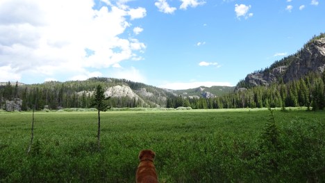
I’m musing again over the name for the impressive mountain that looms above my cabin. “It has no formal name, but we all call it Mt. Herman,” a neighbor told me when I moved here. ‘Mt. Herman’ is a placeholder only, a bookmark in contemporary time, a way to name a mountain in conversation. From old records about this valley, Herman Ellsbury was the first white baby born here. He also happened to be the original homesteader of this property and the man who was commissioned to build the cabin I now live in.

Although I feel Mt. Herman deserves a moniker that acknowledges its dominance and, in my opinion, spiritual significance in this landscape, others take the more traditional route. One of my neighbors, native Wyomingite, Park employee, and scientist, feels history is imbued in the name, a visible fossil of the past and it’s deeds. Yellowstone Park history is communicated in the names of mountains and rivers—Norris, Lewis, Washburn, Haynes, Lamar. Names must be consistent, he tells me, so that they can be found on maps and agreed upon by the general public, or even First Responders. Of course, now we have GPS for communicating an actual location he reminds me.

Another neighbor tells me, in jest, that she is renaming Mt. Herman after her deceased husband. I imagine petroglyph graffiti by white people who scrawl their initials with a date next to ancient images of sacred animals. And if she were serious, she could name officially any unnamed mountain, gap, or other feature formally through a legal procedure that goes into the public record and soon onto maps.

The ritual of naming requires more than a nod to someone we loved or considered influential. Places themselves have power and in a name that power is concentrated and expressed.

“A place must be properly named”, says Laurens van der Post in his novel A Story Like the Wind. In van der Post’s book, all the different tribes in an area in the African bush agree: in order to be protected “against all the negative aspects of the forces of magic” in the surrounding landscape, a place name is necessary.

Samyama is a term described in Patanjali’s Yoga Sutras. It was an expression used extensively by my former teacher. Samyama involves active listening, studying, contemplation, and intuitive awareness. My teacher also referred to this process as a ‘consideration’. I understood it to mean deep, open awareness, contemplation of an issue or a thing or a person or anything, until you beheld its essence. In other words, you’ve ‘considered’ the object of your attention from every possible angle and have now come to understand it through direct knowledge. Robert Heinlein, in his book Stranger in a Strange Land used the word ‘grok’ –an expression of understanding a thing completely through intuition and empathy. Samyama or consideration is the means by which you come to grok something.


Today’s forces of magic in my little valley might be described as many human disturbances encroaching upon the landscape. With the coming of a finished paved road over the mountain in 1992, traffic has increased. And with the increased traffic have come more powerful machinery such as off-road vehicles in the summer demanding more access through new roads deeper into the mountain terrain; hunting no longer done much on horseback, but on ATV’s that drive up and down the dirt roads; trapping all winter long for pelts sold overseas to Russian and Chinese buyers; incessant noise from snowmobiles using the paved road to head into the Beartooth mountains; January helicopter darting of wolves for collaring and counting; fly-over elk counts in winter; logging trucks followed by individuals who buy the slash-piles for firewood sale; summer cattle trucked up to graze on surrounding forest lands. A year round onslaught of noise and landscape disturbance that, taken together, describes a whole host of negative forces that wildlife must contend with year-round. So maybe the real and true name of this stalwart mountain that guards my valley entrance is necessary to discover.

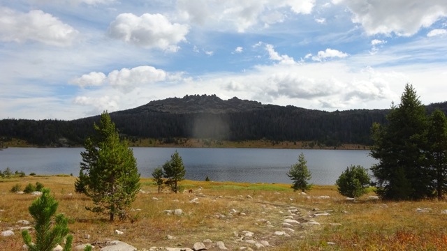
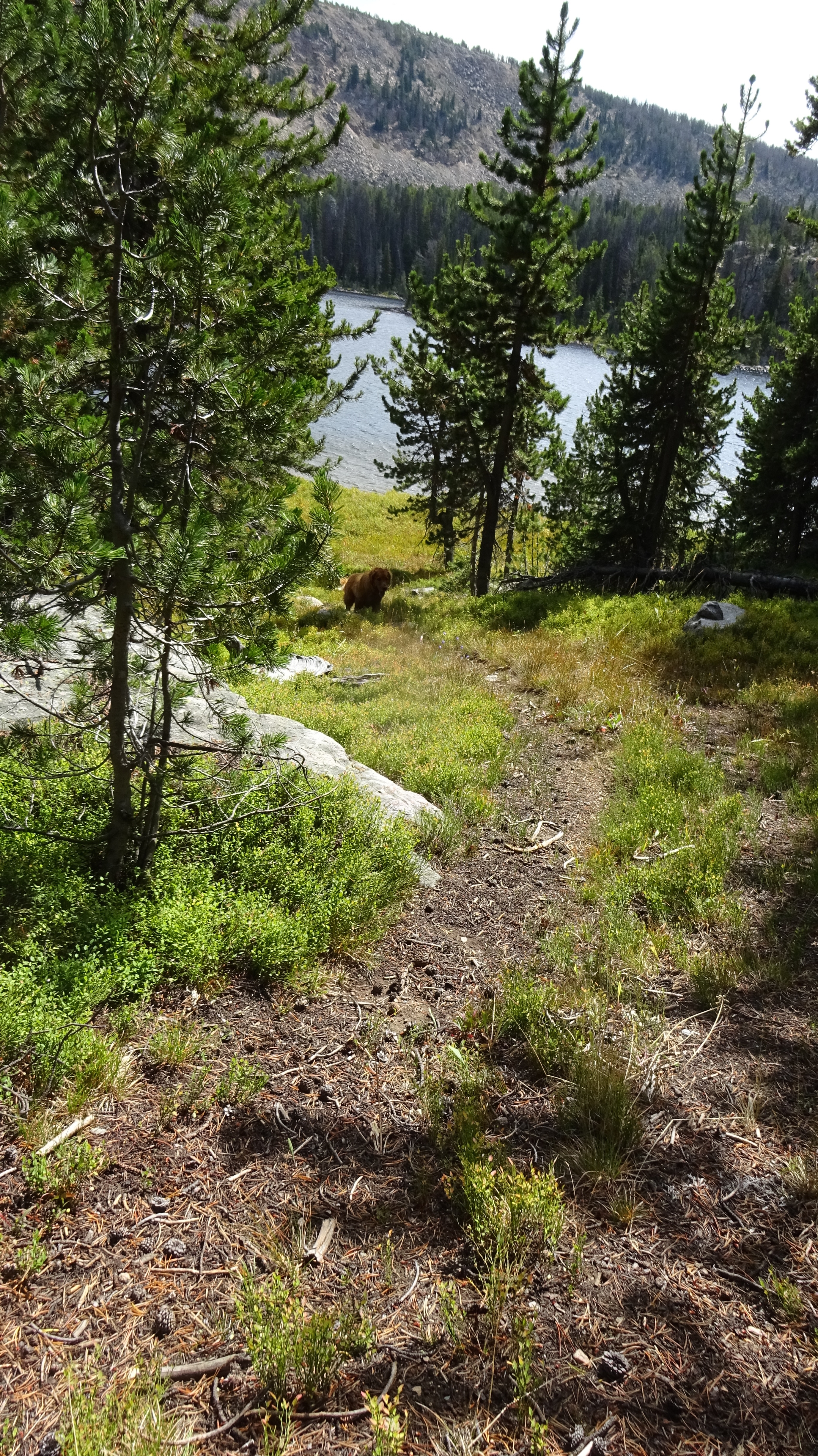
Shaped like a wedding cake melting off to one side, the mountain rises up in deeply wooded layers. As the soil gives way to pure scree, massive boulders scatter the division between tree and rock high above. The mountain’s uplift is so steep no life can take hold. There, a multi-colored prominence, like the hull of a great ship, leans eastward, framing the rising moon. Colored layers of biscuit, cream, deep reds and grays adorn the treeless buttresses of rock one thousand feet above.

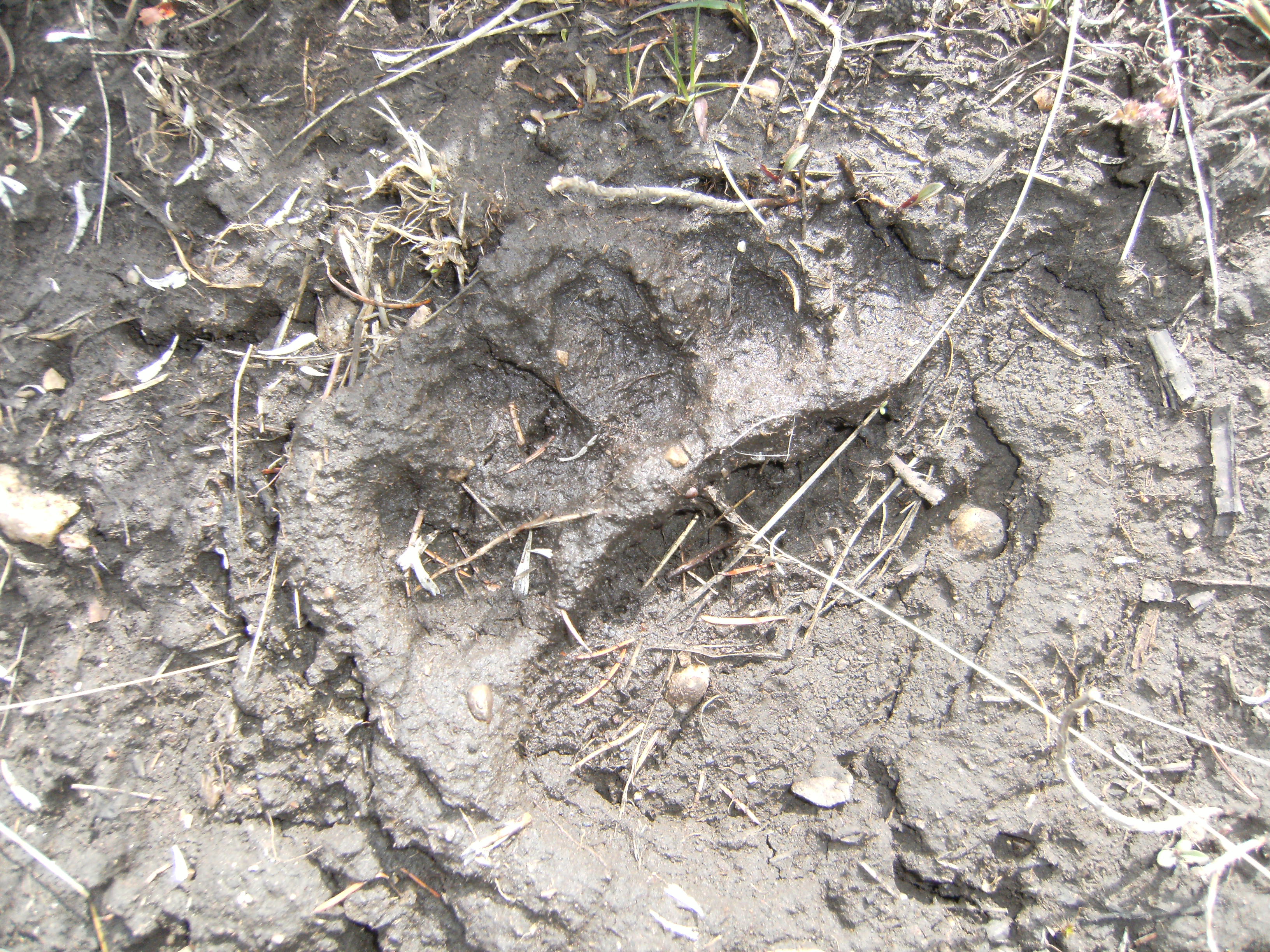
A mountain made of limestone allows water to carve fissures and crevices. Snowmelt seeps into the mountain’s soil. I’ve dug by hand into this earth. Making even a small hole unearths dozens of limestone rock. This is not a mountain made of earth, but of stones. Millions of tonnage of rock creates passageways and dark tunnels where water flows change, move, travel. Near the mountain’s base is where all this water emerges, and not coincidentally, is where wildlife moves through. “From the rock, the mountain weeps” my neighbor tells me. So true.

In that way I began my consideration of my mountain’s name. I’ve admired this mountain for over eight years, but this is the first time I asked it to reveal its true name to me.

Today I remembered a phrase from Aldo Leopold –‘Thinking like a Mountain”. Leopold coined the phrase to mean the interconnectedness of all things. When no wolves live on the mountain, the deer overgraze and overrun it, eventually starving them to death.

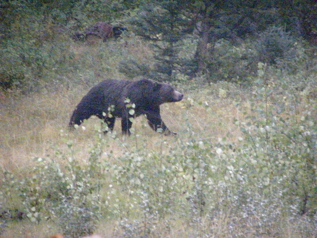
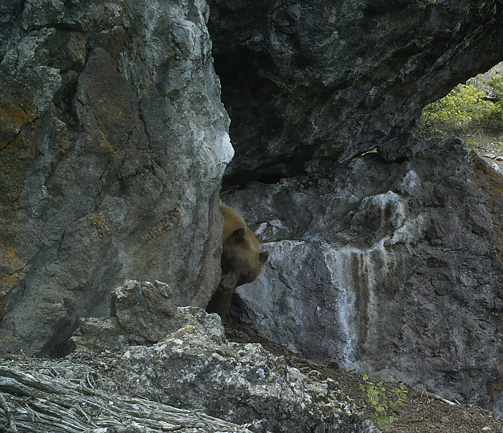
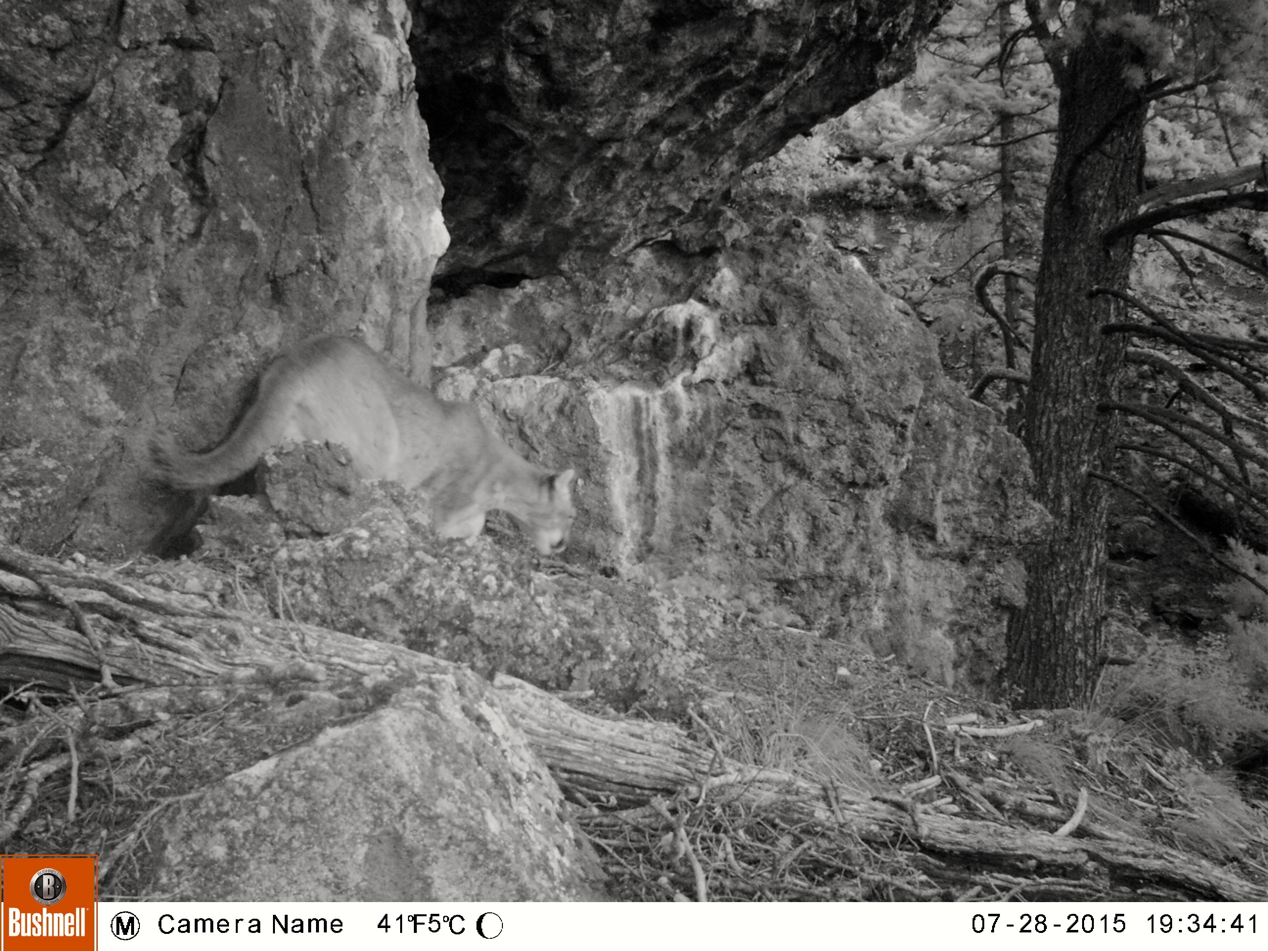
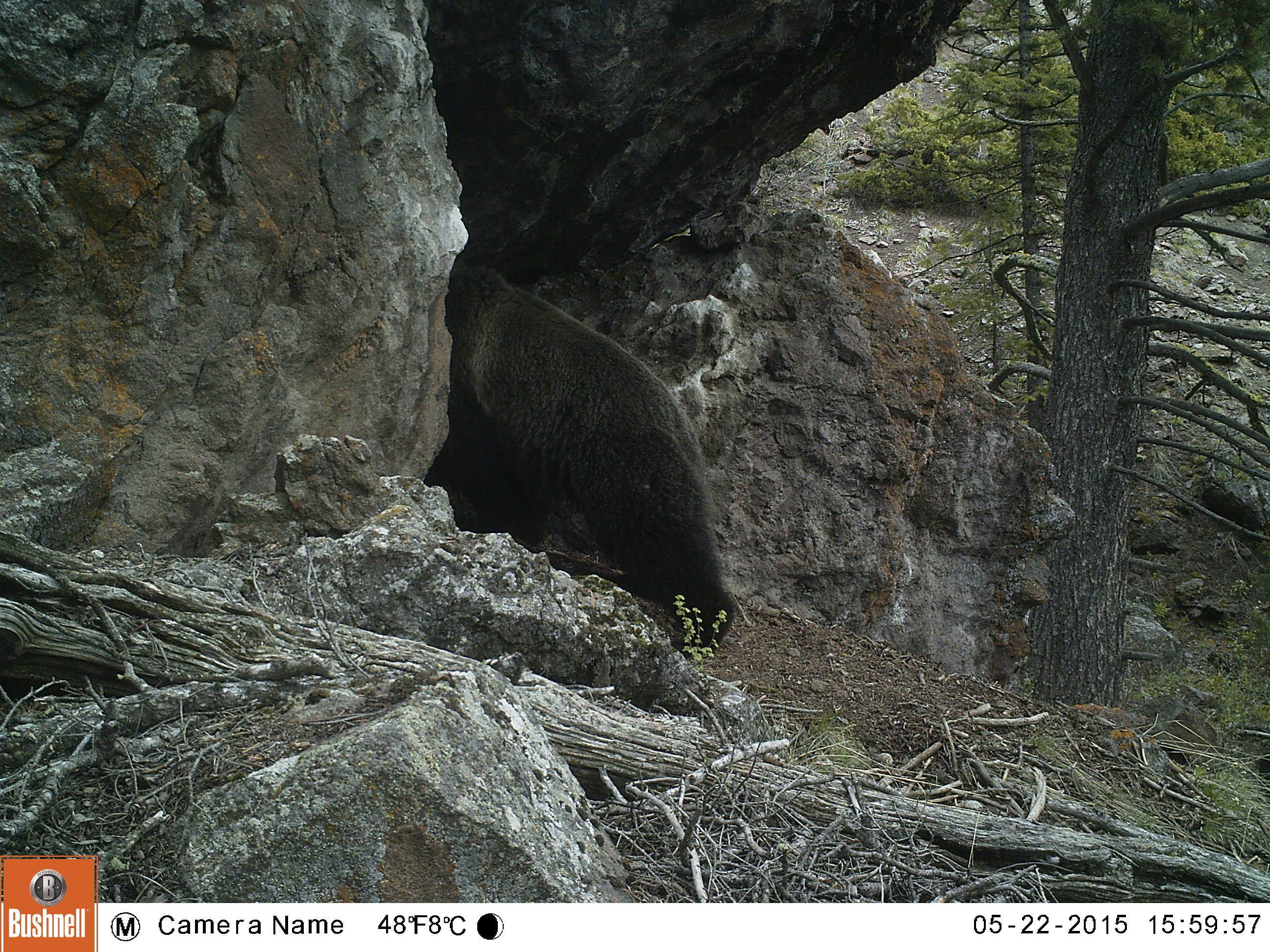
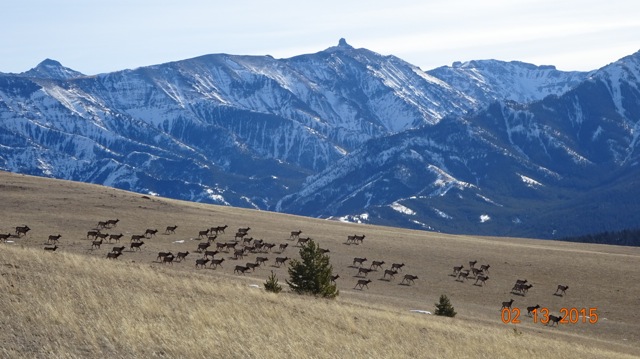
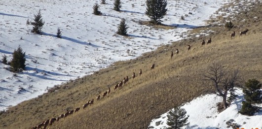
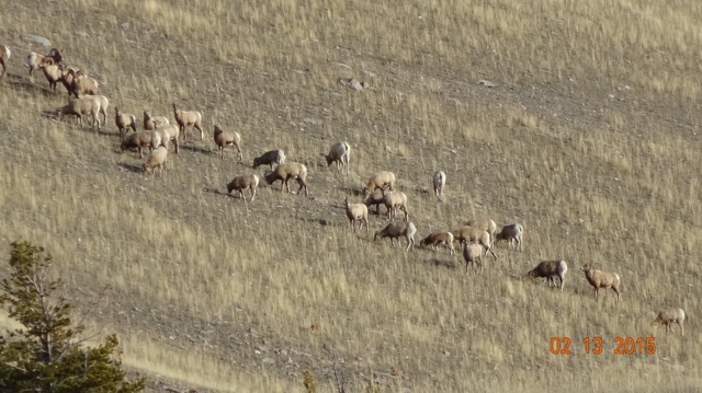
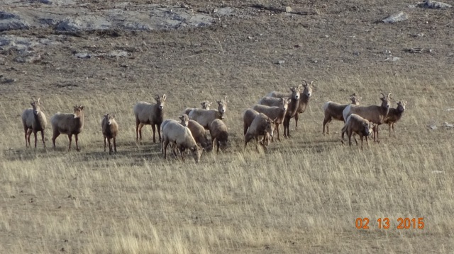
How do you ‘think like a mountain’? I pondered this yet I am not sure of the answer. My mountain, like the mountain Leopold might have been referring to, is home to almost all the wildlife in these parts, with the possible exception of mink (who live in the river below that this mountain streams feed), the eradicated beaver, lynx (although they’ve occasionally been spotted here) and fisher. There are badgers in the sagebrush at its feet, and red squirrels, chipmunks, voles and mice in the spruce-fir forests. Long-tailed weasels hunt the meadow/forest edges, while martens prefer to mingle amongst the thick terraced slopes. Bobcats watch for snowshoe hares, cottontails, and jackrabbits. Mountain lions stalk the numerous deer. Grizzly come and go spring through fall, digging for roots, eating berries and rose hips, tearing apart rotten logs for grubs. Moose browse the willows and dogwood where riparian areas hold the mountain’s run-off, and wolves travel through, making the resident coyotes nervous and watchful. I have yet to see a lynx but the snowshoe hares are plentiful enough to feed them, and I’ve caught on camera a wolverine once. Great Horned, Boreal and Great Gray owls are my neighbors, along with Bald and Golden eagles. Chickadees and nuthatches are among the few small birds that brave the winter cold. Many other hawks, warblers, and small birds spend their spring and summer in the shadow of my mountain.

This mountain is a cradle of Life containing all the necessary pieces to make the whole, a complex and complete recipe to feed all the parts. Thinking like a mountain, like this mountain, must have that as a main component—holistic thinking. And yet, a mountain, by its sheer immobility, its impressive features and toughness, implies no thought, only the present moment.   It will take an open, clear-eyed, receptive, intuitive approach—a reverent approach—to receive my mountain’s name. This is not just a mountain, but also a life support system.

_________


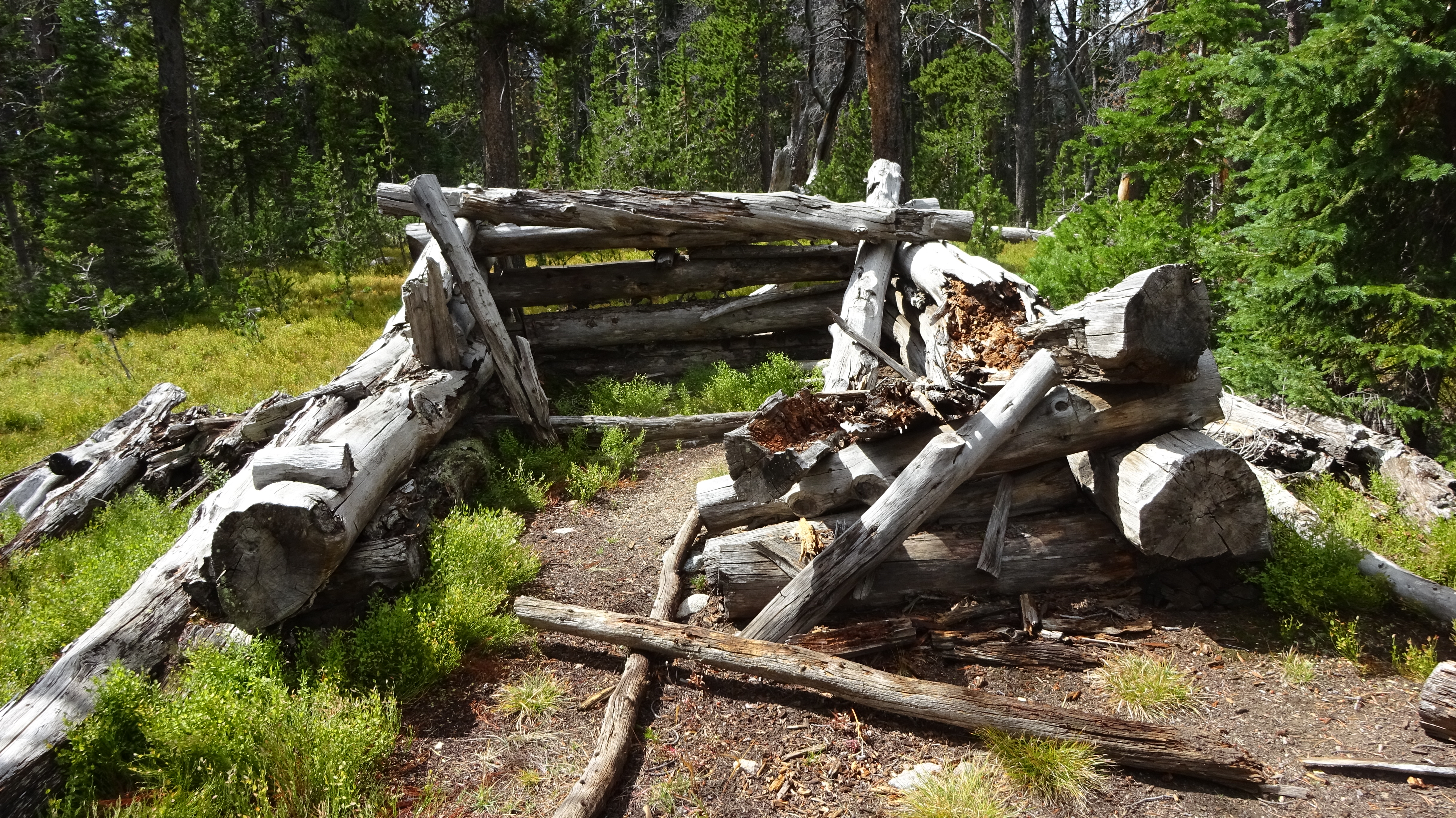
Herman Ellsbury built my cabin for Doc Firor. Ellsbury owned a sawmill farther up the Clark’s Fork Canyon. In 1957 Firor, the new owner of the property wanted a summer home. Ellsbury, whose father originally homesteaded this parcel, which was much larger at the time, knew the area well. He knew where the winds blew from and when. He’d studied the arc of the sun during all the seasons. He could map out the path of the game, where the snows drifted into impenetrable mounds, or follow with a pointed finger where shadows would cast during the winter solstice. These secrets of the Land, and many more, were as comfortable for him as a favorite coat might be for a city dweller. Many people come to my property and comment, “Why don’t you build on the ridge above? That’s the best view.” But Ellsbury had the natural smarts that I always advocate to my clients when I tell them “Live in your house for a few years before you create a garden”. He had that wisdom which comes with living close to the land, observing nature’s rhythms year after year. So he built Doc Firor’s log cabin at the base of a bank, not on the ridge above. He faced it east, what people today might call perfect Feng Shui though this idea probably came from ancient tipi rings in the area, whose doorways always faced the rising sun. By this perfect placement, the cabin avoids our fifty-mile per hour winds that blow frequently in winter. The wooded hillside behind provides just the perfect buffer since the trees create a natural snow fence, and an old irrigation ditch testifies to how he used my creek to gravity-feed the cabin. Because Herman Ellsbury was the first white child born here, the locals saw fit to give this mountain his name as a way of honoring their own settlement, the habitation of what they saw as empty country.

Of course these lands were only empty because the native peoples had been driven out before the homesteaders arrived in the early 1900s. The Crows, who once claimed this area as part of their territory, are now living on a reservation northeast of here; and although in the late 1800s it was part of their reservation, the discovery of gold, the creation of Yellowstone Park and the influx of new settlers shrunk the reservation drastically. Sheep Eater Shoshone Indians, who also called these mountains home for thousands of years, lived a nomadic life, traveling between the Absaroka Mountains and today’s Yellowstone Park. The Park removed them, their way of life shattered by the hoards of miners who diminished their food sources and gave them diseases, the few who remained were moved to the Shoshone and Bannock reservations south and west of here.

Clearly, my valley was inhabited for over 10,000 years. Evidence still surfaces, from native dwellings to the occasional arrowhead. The entire spring outflow, and the swamp created by its emerging waters, was a favorite bison wallow as well as a butchering site for native peoples. In my mind, an injustice was being done with place names that told only a white man’s story, barely a hundred years old.

There is a lesson in the Badger-Two Medicine roadless area that sits between Glacier National Park, the Great Bear and Bob Marshall Wilderness Areas, and the high plains of the Blackfeet Nation in northwest Montana. This wild area is sacred to the Blackfeet, and unlike the rest of the Bob Marshall country, the Badger retains its traditional Indian place names. Why? All the country surrounding the Badger has white man contemporary names, but the Blackfeet fought this tradition and, in 1915, sent a group of Blackfeet chiefs to Washington D.C. asking to retain their spiritual names. The names retain the magic of the area, and it’s long history.

There is one other element to naming that might be peculiar to me. As long as I can remember, I’d had trouble recalling the names of people that I do not know intimately or personally. So, for instance, when I try to remember a valley next to mine named Russell (obviously named after Osborne Russell, one of the few trappers who could write, kept a diary, and trapped the Yellowstone in the 1830s), my mind needs to search for a while. The name Russell does not describe landscape features, but sits like a dangling participle, a reference to nothing that is being observed, nor remembered, as the features of the place. Naming a creek or a mountain after a person signifies a complete disconnect from the Earth and its features.

Between this land’s rich human history, and the nourishment my mountain provided for the abundant wildlife, I was certain my mountain had a name of its own. But what was it?

Sparhawk Lake, Beartooths; ATV’s and Grizzly Bears

An old-timer told me about a forest service cabin down at Sparhawk Lake which J.K. Rollinson had stayed in.  “His cowboy boots are still sitting there.”

That I doubted.

J.K. Rollinson is well-known in our little valley.  He was one of the first rangers in Sunlight and wrote a book that included his time here in the early 1900s.  His book, Pony Trails of Wyoming, describes trips to this Beartooth cabin, peppered with stories about dangerous lightening storms in the high country and leading scientists to collect grasshoppers in Grasshopper Glacier.

I wanted to see if the cabin still existed so I drove to the dirt pullout to Sawtooth Lake across from the Island Lake turnout.  The road is excellent for the first 1.5 miles, then turns to a rocky mess.  I parked and walked the final 2.5 miles to Sawtooth Lake.

Sawtooth Lake, Beartooths

Sawtooth Lake, Beartooths

It just so happened that the Northwest Wyoming ORV club had arranged an outing with the Shoshone Forest Service last Thursday to look at a possible loop trail extension from Sawtooth over to the Morrison Jeep Trail.  The Forest Service, in their 20 year plan, has promised three new ATV loop trails. I couldn’t go on that trip and I wanted to see the road conditions for myself, so I included it in my walk-through. The Forest Service and ORVer’s had driven the road (of course).  I feel you can see much more if you are on foot.

The day was lovely and there was no one on the road–not one ATV or hiker. As I approached Sawtooth, I saw a parked car above the lake.  At the lake I heard gunshots. People were target practicing on a beach at the lake.  I hoped they weren’t shooting in my direction.  I headed opposite from them, in the direction of the adjacent Sparhawk Lake.

The road ends at Sawtooth in a large turnout, but I found an illegal ATV use trail that was headed around the lake perimeter towards my destination.  I followed it until the thick trees around Sparhawk prevented the ATVer from going further.

This is an illegal ATV road that follows the northwest boundary of the lake

This is an illegal ATV road that follows the northwest boundary of the lake

Heading through the trees, I quickly came to the cabin, at least what remained of it. And the Forest Service had placed a nice plaque there. No cowboy boots though.

Sparhawk Forest Service Cabin built in 1908

Sparhawk Forest Service Cabin built in 1908

Another view of the cabin

Another view of the cabin

Plaque on rock

Plaque on rock

Close up of plaque

Close up of plaque

I wondered why they didn’t build the cabin at the adjacent, and very large, Sawtooth Lake.  Here’s a photo of pretty little Sparhawk Lake.

Sparhawk Lake

Sparhawk Lake

I made my way back to Sawtooth and began the return walk.  Less than 1/4 mile from the lake, by a small meadow surrounded by trees, I heard a very strange sound.  A deep and sonorous honking was repeatedly coming from the forest. I stopped, hoping to glimpse what was making these strange noises.  Suddenly a big grizzly was running along the forest edge followed by a cub of the year. Seconds later another cub, and after a minute another cub!  Something had spooked them to run down towards the lake.  I was far enough away, with the wind in my face, that I wasn’t worried. Here’s a link to a black bear cub making a similar noise. Hearing this, I assumed the sound I heard was from the last little cub who became separated from mom.

This area where the ORV club wants a loop trail is in the PCA (Protected Conservation Area for grizzly bears) and with my sighting, it’s obviously a critical area for these bears. What’s proven is that traffic, especially these loud machines, is very disruptive for bears. A loop trail will bring more traffic here. As of now, people are camping right next to the lake creating fire rings. There are no bear boxes to store food in, and car/ATV campers invariably bring more trash in and tend to not pack it all out (or throw it in their campfire rings).

Young grizzly in the meadows by my house

Young grizzly in the meadows by my house

This year we’ve already had several bears destroyed because they were food adapted. There have been stories of restaurants next to, or even in the Park, dumping their grease outside. Bears that find any food rewards graduate to problem bears which become dead bears.

I’m not necessarily against this area looping with the Morrison Jeep road.  By Sawtooth Lake, it’s only less than 1/4 mile to loop the two roads.  But as ATV’s become more prevalent, their riders need to take responsibility for self-policing illegal off-shoots and keeping a clean camp.  The intense noise factor needs to be considered.  In addition, taking your vehicle into the back country and shooting off guns should be made illegal unless it’s hunting season.

Visits to a Cave

Several years ago I found a natural rock cave.  There was a lot of evidence this cave was used by cougars for many years, probably as a day bed.  The shelter is high up within a steep ravine.  Vertical cliffs complete the backdrop. I’ve always been curious who visits this cave.  So this May I put a trail camera on it.  I plan to leave the camera up through the fall but today I went to check what’s been happening.  Despite having to sift through hundreds of squirrel and packrat photos, the cave smells attracted lots of other visitors.Black Bear

Marmot

Elk

Another cougar

Cinnamon Bear

Cinnamon bear

Cinnamon Bear coming out of cave

Cinnamon Bear coming out of cave

Can you find this visitor

Can you find this visitor

Cougar

Cougar

Grizzly Bear

Grizzly Bear

The Health of the Land

With the warm temperatures, the December snows are melted off in most places around here. Because of that, some friends and myself ventured into some high areas that are usually inaccessible this time of year.

The Absarokas and elk

The Absarokas and elk

A glorious day in the high 50’s (how strange for ‘winter), we began the hike without snowshoes.  Sometimes we had to venture through large drifts briefly.  Lots of elk sign but no elk visible.  This is an area where I know a large herd of elk overwinter so I expected to see them at any moment.  As we approached the high meadows, about 250 elk moved down into the valley below and up to the meadows on the opposite side.

Elk

As we watched, two wolves called back and forth from the cliffs above the elk.  Interestingly, the elk continued grazing uphill in their direction as they called to each other.  Clearly, these elk were not disturbed by the wolves presence.  I have always maintained that wildlife are more in tune with each other than humans are with them.  After a while of howling, the wolves went on their way, making distance between themselves and the herd.  Those weren’t the calls of hungry wolves and somehow the elk knew that.

elk moving up the hillside

We moved on and came to a large herd of over 30 ewes, lambs and young rams grazing.  A band of about eight rams grazed on a meadow beyond.  A second herd of over 250 elk was working their way up the hillside.

Bighorn sheep


Bighorn sheep


Ram group

Ram group

On the way back through the willows, four moose were relaxing and munching.

What a brilliant day and great sightings.  I was especially happy to see all the bighorn sheep we have this year in our area.

Moose mom and male calf

Moose mom and male calf

Thomas Jaggar visits the Absarokas in 1893

Arnold Hague began the first detailed survey of Yellowstone National Park and surrounding areas in 1883 .  Thomas Jaggar worked as an assistant geologist under Arnold Hague.  In 1893 and 1897 the lands just east of the Park were the territory to be surveyed, most of which was within the Yellowstone Park Forest Reservation [the forerunner of the National Forests].

Jaggar in Yellowstone Park's death gulch where he discovered 8 dead bears killed by the noxious gases.

Jaggar in Yellowstone Park’s death gulch where he discovered 8 dead bears killed by the noxious gases that accumulate in the drainage.  These bears might have been attracted by the smell of elk that had succumbed.

I’ve been reading Jaggar’s diary of the Sunlight/Crandall area where I live, as well as looking at his photos.  His survey notes include geology notes and other tidbits.  He developed his photos right in the field.  Interestingly, Jagger reports seeing antelope in my basin.  There are no antelope here today, yet there is a local geological feature called Antelope Butte.  What happened to them all, and why they haven’t reestablished themselves is a mystery, for there are plenty of antelope in the basin around Cody, as well as the Lamar Valley nearby.

By 1893, bison had been exterminated and there were already a few cattle ranchers here.  Jaggar reports riding over an ancient local Indian connector trail, entering the valley and seeing “sagebrush, elk, buffalo, sheep & horse skulls and horns.”  Instead of bison, grouse and cattle were in the Trail Creek canyon.  Today cattle don’t run there and I’ve never seen grouse in the sagebrush area.

I hiked to a point where Jaggar took a panorama of the valley in 1893.  In the early 20th century, fire suppression became the doctrine of forest management.  But Jagger’s photo was taken when nature was still allowed to take its course.  In Jagger’s photo below, it appears the trees in the foreground were conifers killed in a fire.  In my photo below Jaggars, I could barely find a angle that I could take the photo without trees obstructing the view.  But my photo is taken from basically the exact same location.

1893 Photo

1893 Photo

2014 same location

2014 same location

Aspens are the first trees to regenerate after a fire.  A few years ago I accompanied Larry Todd, a local archaeologist, to survey some old wikiups [Sheep Eater Shoshone houses] in one of the small drainages off the valley.  Although these wikiups were standing in the 1970s, cattle feeding on the Forest Service grazing allotments liked to rub against them, and so knocked them over.  By examining the logs, Larry was able to determine the age of the wikiups was 300-400 years old, and surprisingly, these logs were all aspen.  As you can see from the photo below [wikiup logs are in the pile], the forest is all conifers now.  Aspens live for only 80-100 years.  The next in the succession in this dry area would be Douglas Firs, which can live for many hundreds of years, suppressing any new aspen growth.  Without natural fires, the forest will be dominated by conifers.  So this forest used to be all aspens, and probably was a much wetter environment.  Larry pointed out that the climate 300 years ago was different here.  This wikiup sits are the confluence of two seasonal creeks but at that time these creeks might have run year-round.

300 year old wikiup standing till 25 years ago when destroyed by cattle

300 year old wikiup.  Pile of logs are the remains of an aspen wikiup.


The Wild Excellence: Notes From Untamed America

My new book is finally available from Amazon.  The Wild Excellence:  Notes from Untamed America takes its title from a Pablo Neruda poem.

Without doubt, I praise the wild excellence

The Wild Excellence

Over 60 years ago, Aldo Leopold proposed a new way of looking at land. He called it ‘The Land Ethic’. This view is the model all conservation groups use today. In my book, The Wild Excellence, I propose to broaden that template to include another element: our ancient relationship to Land as source of vision, spiritual awareness and awakening–The Sacred Land Ethic.  This idea of mine did not come out of a vacuum, but naturally evolved from living in this wild ecosystem of the Greater Yellowstone.

In my book I tell the story of how I was transformed through direct connection with wildlands and wildlife:  I work on a wolf project; my valley is the center of an elk study that reveals very interesting data; I track bears, find coyote dens and search for evidence of first peoples–all in this unique ecosystem, living just a few short miles from Yellowstone National Park’s eastern border.

Observing wildlife and wild nature changes my views on the Land and how we must treat it.   From the Epilogue:

I walk out into the night air and the brilliance of the evening sky intrudes upon my feelings.  The celestial dome above me is packed with star light.  The local wolf pack is howling.  They’ve made a kill nearby and with their bellies full, they announce their pleasure into the blackness.  A rustling of hooves beats back and forth in the large meadow in front of the house.  I go in and grab a high beam flashlight.  As I shine it towards the pasture, a thousand eyes stare back at me. The elk herd has come.  Disturbed by my dog and the nearby wolves, they move restlessly as my beam tracks only their eyes, focused on me with curiosity and fear.  Something familiar rustles through my bones.  My flashlight becomes a torch, my house the village, and I sit with friends around a fire, ten thousand years ago, with this same sea of eyes staring from the darkness.  There is an eeriness to it, and a vulnerability.  And a rightness.  I feel my humanness and my place in the Universe.  I am grateful, once again, to be living here, in one of the last places on earth where all things are intact.  It is my home and without any doubt, I praise the wild excellence.

Some praise for The Wild Excellence:

Narrating from the borderlands of Yellowstone National Park, Leslie Patten brings us vivid accounts of wolves, grizzlies, the seasonality of ecosystems and tales of prehistoric Indians–all written with a naturalist’s eye and woven in a personal network of modern day homesteading, dogs and community. There are times when the best reporting on national parks comes from voices just beyond the legal boundary, close enough fora passionate attachment to the beauty of the land but sufficiently distant for critical appraisal of governmental management. Leslie Patten is one of those voices.

— Doug Peacock, Author of Grizzly Years, In the Shadow of the Sabertooth

 “The Wild Excellence” belongs in every library and personal book shelf. Leslie lets us enter her world of wilderness and all its beauty and wonder. Then encourages us to preserve all that is wild for future generations. Her words, “The grizzly bear’s gift to man is the Power of the PresentMoment” sums up the essence of this book.

— Dan and Cindy Hartman, Photographers Yellowstone Ecosystem Wildlife Along The Rockies


I hope you will buy my book, enjoy it, and be moved to love our remaining wildlands and wildlife.  If you do, please leave your comments on the Amazon page.  That will help more people find the book and read it.  My sincere hope is that all the million plus people who visit this Ecosystem every year will come to support this unique area with their voices and their vote to protect it for future generations.

Grizzly front foot

The Tipping Point

Everything is up for grabs now relative to climate.   Climatic tipping point talk is abuzz about the scientific community.  All our efforts to save species have a large ‘unknown’ given rapid ecosystem changes due to climate instability.  The tipping point, researchers say, may be within just the next 10 years.

For the last several years, I’ve taken to setting up my trail camera all summer in the little forest by my house.  The forest is home to 7 springs that emerge from the limestone underground rivulets hidden deep within the abutting mountain.  These springs flow into private lands, much of which is soggy and marshy.  The forest also is a lively travel corridor.

Spring area, one spring

In previous summers I’d pick up my trail camera chip every few weeks.  Mostly I’d see deer, a few coyotes, and an occasional black bear.  By fall, the grizzly activity increased.  But this summer–the hottest on record and with an even hotter heat index making almost every day unbearable–activity has increased dramatically, and of course, always at night.  I’ve had scores of black bears, cougar, a boar grizzly, and even a moose a few weeks ago.  Given that moose go into heat stress at temperatures above 57 degrees, and anything above 80 degrees is unsuitable for them without refugia, I wondered how this poor moose was coping. (notice the temp and time!)

These animals would normally be higher up this time of year.  But my theory is that the constant heat and drought has forced them lower.  Of course, this is not the case across the board or we’d be seeing a lot of wildlife in the irrigated areas.  But I take this as a sign of the future–as we use diminishing precious water to irrigate pasture or grow crops, we’ll see more wildlife seeking refuge closer to us.  As prey move in, so do predators.  As forests die and meadows dry, animals will seek food and water wherever they can find it.

Couple that with the sad state of food for grizzly bears.  Today I took a long hike up the back side of Windy Mountain, once a stronghold for Whitebark pine nut food.  The trail begins around 8,400′ and heads up to 9400′.  I can say with confidence that 99% of all the mature Whitebark Pines are dead throughout that ecosystem.

Dead Whitebark Pine forest

The only good news is that there are young seedlings in many areas, especially on the north-west slope in a large burn area.  But these trees won’t bear for at least another 30 years–if they survive the dramatic shifts in climate.

A friend told me not long ago that all the still affordable lands are high up in mountainous territory.  These are the areas, he said, no one wants to live in because the climate is too harsh.  Real estate in places like Oregon, Washington, the Southwest, and California is beyond pocketbook reach anymore.  But evidence points to humans heading into the mountains in the Altithermal, a period of drought and dryness after the glaciers melted.  Animals, as well as people, may be heading higher up sooner than later.


Hike up Cottonwood Canyon at the base of the Bighorns

What a lovely hike that I highly recommend.  Cottonwood Creek is one of several canyons on the western side of the Bighorns.  The turnoff is just past the bridge over the reservoir on U.S. Highway 14 Alt.  This is the Little Mountain Travel Management area on BLM lands.  A newish looking campground, equipped with nice outhouses and even a pergola dedicated to Senator Craig Thomas  (no water though) makes an overnight stay inviting so you can explore all the other back roads and canyons.

I did this as a day hike.  The trail runs parallel to the creek, where of course Cottonwoods grow, as well as Willows, Serviceberries, Chokecherries, Big Sage, Mountain Maples, and a shrub I couldn’t identify.

Unidentified plant. Suggestions?

These photos don’t do the Canyon justice.  It is striking, overwhelming in its’ beauty, with massive, impressive cliffs and waterfalls surrounding your climb higher and deeper into the canyon.  The trail eventually reaches the Forest Service boundary.

Start of the hike


Near the hike’s beginning


A few miles up and a lunch stop


Unusual cliff formation


Looking back toward the Bighorn Basin from up the Canyon


I am so lucky to live in such a diverse area, with the playground of the high desert of the Bighorn Basin, Yellowstone and the Absarokas to the West, the Beartooths to the North, and the lovely Bighorns and sacred Pryor Mountains to the East.