• MY BOOKS ON WILDLIFE, GARDENING AND MORE

  • The Wild Excellence

  • True stories of wildlife encounters around the Greater Yellowstone
  • Award winning eBook on Decomposed Granite, tips, how to's, what to watch for
  • Children's book. True stories of a dog and wolves. In a dog's voice
  • Written for dry Mediterranean climates in California, north and south

Beartooth Highway Memorial Day 2009

Took a ride on the Wyoming side of the Beartooth highway yesterday.  Amazingly, with all this snow, its open now.  I live about 20 minutes from the highway, and only drove up to Long Lake.  Its like winter all over again up there, while its fast becoming a distant memory down here at 7500′.  In places, water was flowing fast across the highway.  Large chunks of snow had fallen and blocked a few places, but the crew seemed to clear them pretty fast.  Here are a few photos taken yesterday of the highway Charles Kuralt called the most beautiful highway in America.  If you go, bring your skis.

Badlands, Wild horses, and natural gas wells

Yesterday was the Greater Yellowstone Coalition (GYC) Cody Chapter annual spring hike.   This year they decided to go to McCullough Peaks, outside of Cody.  McCullough Peaks is badlands east of Cody.  It’s also a wild horse preserve and parts of it are Wilderness Study area.

McCullough Peaks, named after Pete McCollough who drove cattle to the southfork in 1879 for Judge Carter’s cattle company, is a stark and beautiful landscape.  The earth tones vary from reds to purples to shades of tan.  Numerous and dangerous sinkholes line the broken trails.  Its a land that one might look at and say “Nothin’s here”.  But I’ve hiked it twice now in the last three weeks and I beg to differ.Badlands, McCullough Peaks

My first hike several weeks ago the land was just beginning to green up.  Now’s the time the desert is fertile and blooming, lasting about a month.  You have to time your hike a few days after a snow or rain, otherwise the mud is a murky maze, hard to avoid.  One of the GYC members said this land is part of the Crocodilian age, rich in fossils from the Eocene, 38 to 58 million years ago when seas covered and then receded from the basin.

Hiking close to the herd, W__ and I kept our 50′ distance, but the wild horses decided to check us out more closely.  A mare and her foal came over, sniffed us, and decided we were fine to be on their land.  Its amazing these horses can even survive.  With rainfall only 5 to 8 inches a year, they seem to find food.  The BLM maintains some stock reservoirs that the horses use, as well as the open range cattle.Wild Horses

Wild Horse

The GYC hike was to Peak 6224.  Although it’s only about a mile distance, I found the trek difficult going up and down barren, steep, slippery soil.  From the summit of Peak 6224, you could see the entire basin–Carter Mountain, Heart Mountain, north to Beartooth Plateau and Powell, east to the Pryors and the Big Horns.  The greens of the new grass highlighted the hues of reds and purples, with the snowy peaks as a backdrop.  It was beautiful.  Purples of desert soil

Sinkhole, some are large enough for a man to fall through

View from the peak looking east

GYC chose this hike because on the other side of the road from the hike is where the proposed Natural Gas development is.   At the end of the hike we continued on the road over the hill to view the site.  One well has already been drilled and the toxic waste holding pond is full.  The 6 acre pad is built, but because of low gas prices right now, the well is waiting to be functional.

Open smelly pit with toxic hydrocarbon and chemical waste

This pit is supposed to be protected from birds as well as mammals

Gas pad still not reseeded and recontoured

6 acre pad should have been reseeded and recontoured

Hillary Eisen of the GYC staff explained that this is the first of many proposed wells in the area.  This well was an exploratory drill and they seem to have found enough gas to justify continuing.  She also explained that the 6 acre pad is allowed for the trucks to get in and create the well, but they’re supposed to have re-contoured and seeded the area by now, which they hadn’t.  Also she said that they don’t need to have an open pit for the toxic water waste; that it could just as easily be in a container.  The pit is supposed to be covered so birds can’t get in.  The pit had a real toxic smell.  In addition, there was garbage everywhere when we drove up.  They’re supposed to clean up the mess they leave.

This is the well, capped for now because prices are low.

This is the well, capped for now because prices are low.

This well is on state land.  Several of the others are on BLM land.  The state leases parcels of land with little environmental impact necessary.  They justify their leasing on the basis of the land paying for schools.  The BLM as a federal agency requires input from citizens and reviews.  But, Hillary explained, almost 100% of the time they approve development requests.

Once the wells are drilled and operating (when natural gas prices go back up), either pipelines need to be built or trucks will be going in and out to transport the gas.  Traffic will increase, more holding ponds with more toxic waste will be built, and a large generator for the pumping will be operating 24/7.  The noise from this generator will be constant and deafening.  McCullough Peaks will be a very different place, more on the order of a mini-Jonas field.  The solitude that makes parts of these lands eligible for a Wilderness area will be no longer.Beauty and solitude of McCullough Peaks Wilderness Study Area

Natural gas may be, as Hilliary explained, our transition fuel to greener technology.  It has a lower greenhouse gas impact than oil does.  But that doesn’t mean we can’t drill in more conscious ways.  This site, with the garbage strewn along the road and the plot, the negligence in restoring the area, the open unnecessary and smelly pits, as well as the types of generators that will be involved with the noise levels in the future–all that is done in the name of low costs.  I would call it pure neglect and unconsciousness.

“Don’t let people push you and say you have to provide energy for the nation.  It is not unreasonable to say there is a point at which we don’t want this to become an oil and gas Appalachia.”–Gov. Dave Freudenthal

The Thompson Cabin

A few summers ago,  my cabin’s original owners’ son, T___, came visiting from West Virginia.  He is a surveyor and had some maps of the Clark’s Fork Canyon.Clarks Fork's Canyon with Sunlight Falls

“There’s a box canyon over here”  he pointed out, “with an old cabin sitting by the river.  They call it ‘the Thompson Cabin’ cause old man Thompson lived there in the 1880’s.  Well, that’s the story I heard.  They say he trapped and made moonshine.  That once a year he took his furs on his mules, and went over Dead Indian pass into Cody.  He’d take them to the trading post and while they decided on what to give him, he’d go drink his money away.”

T___ didn’t have time to hike to the cabin, but he gave me a good idea where it might be.  Following his map, the box canyon was easy to find.  The cabin sat on the other side of the river, which was low enough to cross by way of deadfall.  Thompson Cabin

The cabin itself was awfully small.  The windows were gone of course, but the frames were nailed with square nails.  The locals and kids had camped and left bottles there over the years, but a depression still marked the old root cellar.  It was just hard for me to imagine living in such a small little box.  It gave me great respect for those old-timers.Square nails in the window frameDepression at the back is the cellar

Thompson had situated his cabin on the south side of Dead Indian Creek which made sense, because in winter and spring the creek would be hard to cross.  I’m not exactly sure the path he took his horses or mules, but I could scramble up the hillside and be close to the main road.  Of course, there wasn’t a road then, but the road that’s there now follows fairly closely old Indian trails over the pass to Cody or up towards the Park.

I told my friend JB about it.  He’s the old man who grew up in the valley.

“Thompson, I remember him from when I was a kid.  My grandfather used to go visit him.  Thompson would invite him for dinner.  One day he was helping wash the dishes, when Thompson took the dishrag and blew his nose in it. ‘Time to leave’ my grandpa said.”

“Thompson had a big garden there.  He grew potatoes, and carrots, watermelons and lettuce.  Then he’d take his fare up to Cooke City to sell.  Took him two days by horseback.”

Sometimes I run into old cabins.  Once I ran into one in the Beartooths at Stockade Lake, probably an old forest service cabin.  There’s some at the end of my valley that were old mining cabins in the early 20th century.  I know the old ones in Yellowstone are usually destroyed when they’re found.  But the Thompson cabin held an interesting history for me, and at least one that I heard some yarns about.Old miners cabin from early 20th century

I like the area the cabin is in and hike there frequently. Nearby, I found a rose quartz vein and an eagle feather.

On the other side of the river, there’s a small flat open plateau, and that’s where the magic resides.  Its sunny and peaceful.  I like to go over there and explore the cliffs and look under the trees.  Then I heard from another local that the plateau is an old Indian winter campground and he’d found arrowheads there. I supposed I like it for the same reason the Sheepeaters liked it and old man Thompson liked it.  Besides being protected from the wind and snow, having year round water, safety from enemies,  good trapping and fishing, easy trail access– it just has a good feeling.

Coyotes and Communists

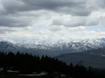
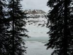
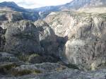
Oregon Basin is sagebrush desert surrounded by sandstone formations outside of Cody.  It’s desert hiking with so many things to explore.  I’ve only been there a few times.  Its a maze of BLM dirt roads, mostly used for oil and gas explorations.  One of the oldest oil fields in Wyoming, coal was also mined here from the late 1890’s to the 1940’s.   Old mines and buildings can still be found. But long before all of this, Native Americans camped and hunted in the basin.

On one of my few explorations here last year, a friend took me to a petroglyph site.  We drove through barbed wire gates, mile upon mile of windy dirt roads, past working derricks, until we parked alongside an abandoned coal mine.  We walked around a sandstone ridge to a small box canyon.  Protected from wind, it was the perfect campsite.  That’s where the petroglyphs were, along with a giant rattlesnake.  Sadly, many of the glyphs were defaced and beer bottles and trash was strewn around.Oregon Basin, Cody

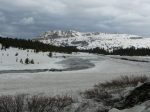
I really like exploring the desert and its formations.  W__  spent 20 years hiking the basin and surrounding badlands.  Today we turned off onto a dirt road from the Meeteetse Hwy.  Someone had been killing coyotes and dumping them there.  Two fresh kills  attracted several Golden Eagles that flew off as we drove bye.  More old coyote carcasses were strewn along the way.  Coyotes rank as predator status.  That’s the status that Wyoming wants for wolves, which means it’s legal anytime to shoot the animal on sight.

I asked W__ why someone would be shooting coyotes around the basin.  There’s no sheep here anymore, just cattle at certain times of the year.

“Because its something to do”, he answered.  “Someone is baiting around here, so watch your dog.  There’s traps.  Do you know what a coyote trap looks like.”

I told him I didn’t.  W__said that by law a trapper is supposed to hang a sign, like a rabbit’s foot, by the trap.  We hiked over the hill and alongside a sandstone ledge.  Almost immediately he said “Here, I’ll show you what to look for” and took me over to a small overhanging rock with a 2×4 piece of wood half buried.  Attached to the wood were two wires.  “This is what they wire their traps to.  I stepped in one once.  They didn’t sign it, and it was half buried in snow.  Luckily, it didn’t get much of my foot and I could wiggle out.”  I tore the wires away from the wood and tossed them.

We talked for a while about random coyote killing with no reason.  W__is my philosopher and preacher friend.  “Always gotta have something to blame your troubles on.  Used to be the ‘communists’.  When I first came to Wyoming, everything you didn’t like got blamed on the communists.  When that went away, it became the coyotes.  With the sheep industry mostly gone, now its the wolves.”

I told him a story about my old neighbor, JB.  Only a few days ago we were talking about something contentious, maybe the economy, when suddenly he said “Its the communists.  They’re the ones doing all this.”  I was certainly puzzled.  Then he looked me dead in the eye and asked “You’re not a communist, are you?”  I had to laugh.  I’ve been accused of a lot of things, but that was so ’50’s!

We walked around ledges, exploring all the niches.  Koda kept busy looking for jackrabbits.  Rabbit scat seemed to cover every inch of the desert.

“I’ve found a few arrowheads in the Basin.  Once I found a scraper.  Never found that much though.”  We came across a ‘boneyard’, an area with a large scattering of small bones from jackrabbits, gophers, and mice.  W___ pointed out a ledge that contained a small cave that looked like a coyote had set up camp there in the past.  I found a perfect gopher skull inside.Sandstone formations

With the desert sun warming and the ground was free of snow, we choose a windless large smooth boulder for a lunch spot.  I passed some time picking sticky bentonite clay from my boot soles.   In the distance, a herd of pronghorn lazed and ate.   I’d just watched an episode last week of Wyoming’s Congresswoman, Cynthia Lummis, tell Stephen Colbert that the Pronghorn is the world’s fastest animal.  Colbert made a big deal out of correcting her, saying that the Cheetah is the fastest.  But in a sense they were both right.  Those Pronghorn can sprint as fast as 60 mph and sustain a speed of 30 mph for miles.  Cheetahs sprint faster but flag out after a few hundred yards.

When I first got here, people told me Pronghorn were related to goats.  They’re not.  In fact, they’re not antelope either. They’re completely their own thing.  Antilocapra americana are the sole surviving member of a family dating back 20 million years, which means they’re an ancient animal.  They don’t quite fit into any category.  They have horns that are somewhere between antlers and horns,  that shed and are branched; they lack dew claws, and  can pick up movement 4 miles away. They are super fast and love a good race.  There are many stories of them racing cars at 60 mph and beating them.    At one time they were probably as numerous as the bison, and were slaughtered at the same time.  Today most Pronghorn live in Wyoming and Montana, and probably total around one million.  Male Pronghorn

We  headed back towards the car and I picked up a small old pronghorn horn.  I dropped W__off and did some shopping in Cody.  In the health food store, I noticed at the counter there was notice urging me to call my congressperson about a bill to make organic farming illegal.  The sheet said that Monsanto, the GMO giant, was behind the bill.  I talked with the store owner about it.

“Its’ outrageous.”  he said.  I agreed.  Monsanto are corporate crooks, I added.

“You know who it is, don’t you.”  He looked at me perfectly seriously and said, ” It’s the communists.”

And even I started to think, “Maybe its the communists who were killing those coyotes.”