• MY BOOKS ON WILDLIFE, GARDENING AND MORE

  • The Wild Excellence

  • True stories of wildlife encounters around the Greater Yellowstone
  • Award winning eBook on Decomposed Granite, tips, how to's, what to watch for
  • Children's book. True stories of a dog and wolves. In a dog's voice
  • Written for dry Mediterranean climates in California, north and south

What the Lamar Valley has to offer in May

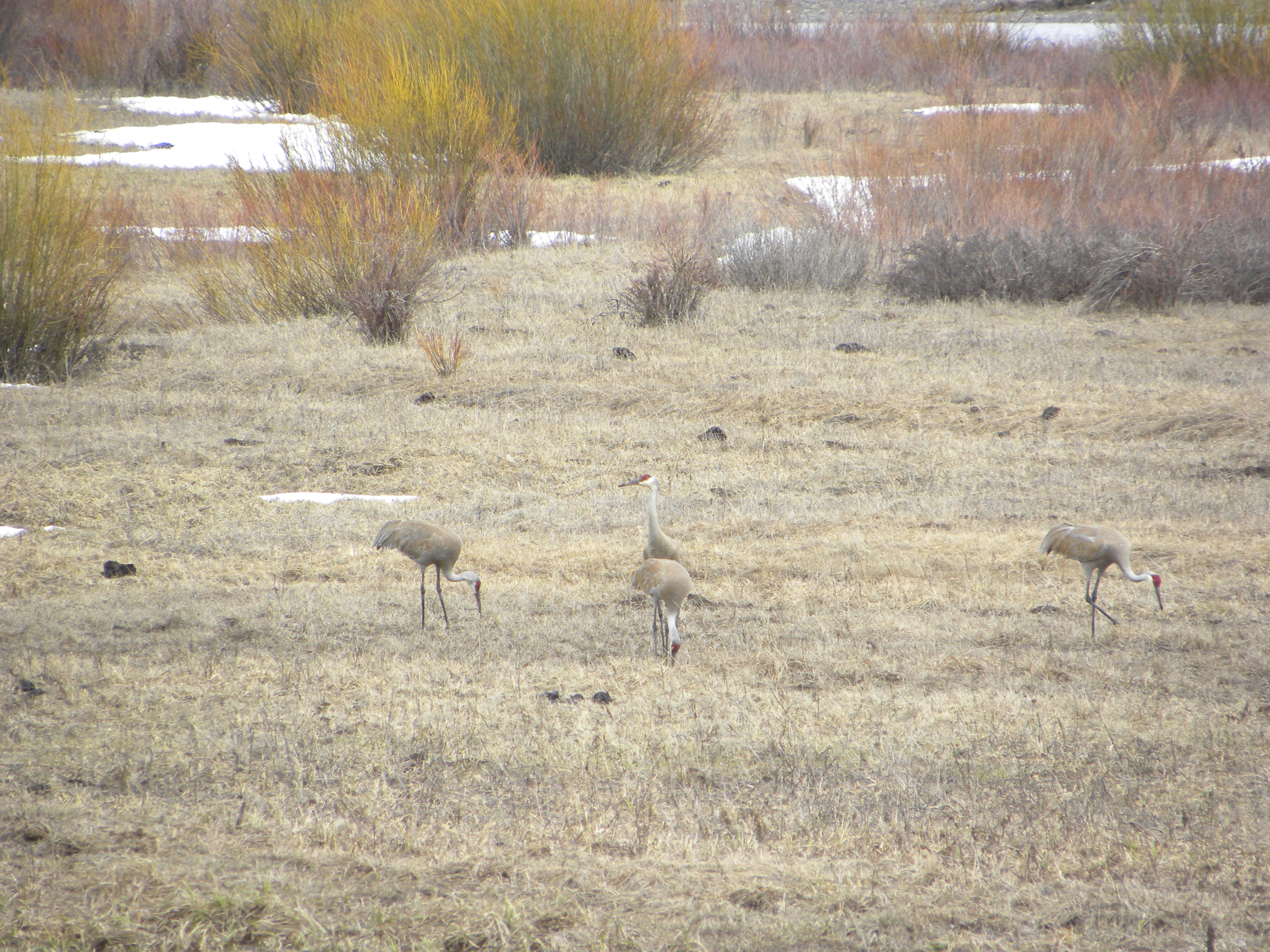
A cloudy, snowy, cold Mother’s Day.  I like to head into the park on Mother’s Day and try to see babies.  I’m so close to the Lamar Valley, just one hour to the Buffalo Ranch, that I usually don’t get much further, and don’t need too.  All photos below are from today.

A few Mother’s Days ago there was so much activity in the valley–wolves on wolves competing with bears, coyotes and bison babies, you-name-it.  Today was a different Mother’s Day.  The Lamar activity has calmed down in general.  With few wolves, there is just less activity.  But spring is always an excellent time to see bears and today was no exception.

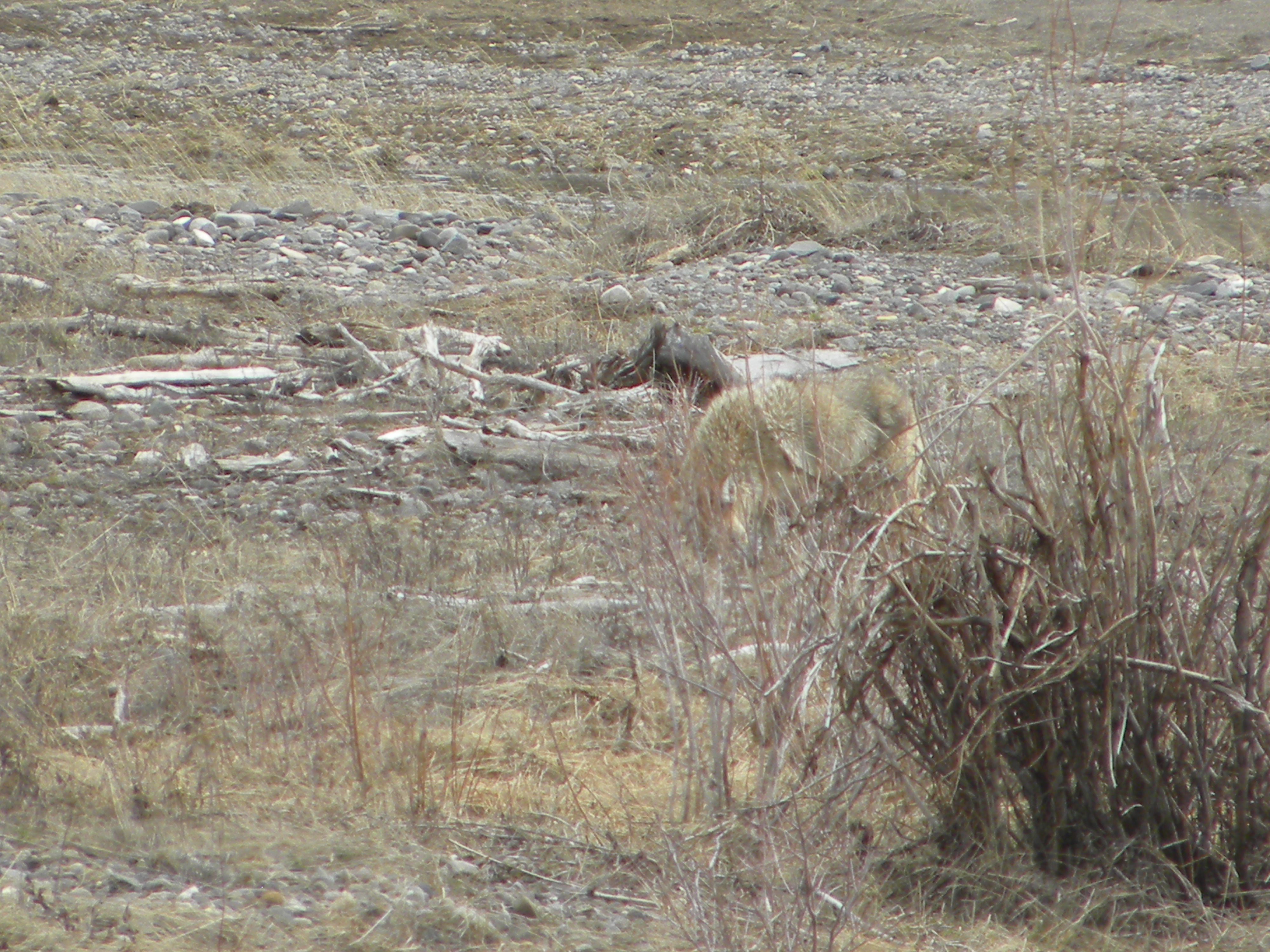
I saw a total of 5 grizzlies in the Lamar–a mom with 2 yearlings, and two boars. Grizzly 
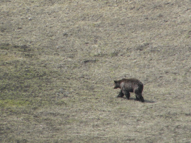
The boars had a brief face off for a few tense moments, but the bigger one just went his way.  Bighorn sheep rams stood by the roadside; a coyote was on a bison calf carcass, and the bison babies and moms were all along the road.  I watched a wonderful scene of a young frisky bison calf jump around, then come back and nuzzle his mom.  The mom and him butted and rubbed their heads, then he was off romping again.Bison and nursing calf

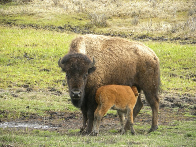
What strikes a person traveling through the Park is how many people LOVE to visit this area, and some many times a year.  I spoke with a fellow who travels here at least 4 times a year from Rhode Island.  He comes in winter to Jackson to photograph elk on the refuge.  Then he returns for the antler auction, trying to match up his photos with a matched set of antlers (75% goes to the Refuge, 25% to the local boy scout troop who do the collecting of the antlers).  He comes other times just for wildlife watching.  Many of the people I spoke with come out every May, staying outside the Park at the gateway communities.  Some people come from as far away as England.  Some have even bought second homes here.  And what are people looking for when they come–they all want to watch predators!  “I want to see a bear” one person told me.  They’d like to see wolves, bears, foxes.  It’s easy to see elk, bison, and antelope.  But predators are exciting for people to watch.Bison babies

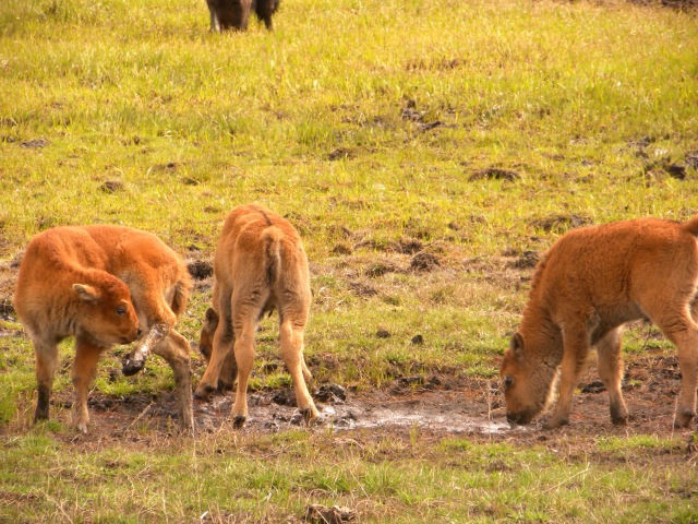
And the predator that is now obviously ‘missing’ in the Lamar viewing experience is the wolf.  Although there is a pair there who have pups, two grown wolves are hard to spot, as compared to over a dozen in the pack just a few years ago.

From where I sit in my valley, the wolf hunt has hit the Lamar hard as these wolves travel back and forth in the winter time following the migratory Lamar elk herd outside the Park.  The Wyoming Game and Fish has proposed an increase in the 2014 wolf hunt numbers.  Most areas would have an increased quota–my area 2 would be increased from 4 last year to 5 this fall.  In 2013 5 wolves were killed, one above the quota.  There is a confirmed pack of 6 wolves here.  Why is the quota most of the adult pack?

Please take a look at this sane proposal below from Brushback Guide Services.  They propose Tourist and Science zones next to the Park with either 1. no harvests, depredation only or 2. extremely low quotas with a buffer of 10-15 miles around the Park, thereby tightening the areas or 3. very limited shortened seasons in these special zones.

This proposal would protect the tourist economy as well as balance with those who want to hunt wolves.  A continued increase in the wolf hunt will only have continuous impacts on the Park and the wolf population and pack structures in the Greater Yellowstone area.

Wolves, and all predators, should be appreciated for their necessary impacts on ecosystems.  They are needed in the ‘web’.  They manage the meso-predators, they foster healthy landscapes, they provide food for other large predators such as bears, and for thousands of years ungulates have been evolutionarily healthier because of their presence.  Ram

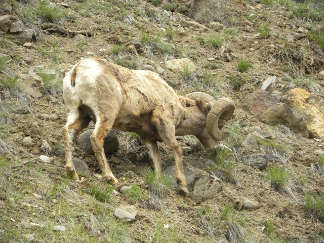
Yet the reality today is economics and dollars drive the argument and the management policies.  So here is what Brushback Guide Services proposes that I think works.  Proposal #1 is what I prefer:

Proposal 1- Science & Tourism Units

Units that are important to wildlife viewing would be considered “Science & Tourism Units” to allow scientists a chance to keep ongoing wolf studies without having so many wolves taken mid-life before their full potential data is reached. The other purpose for these units is tourism. Tour companies can show people wolves in areas where they are not hunted better than areas where they are hunted. These units have good road systems for tourism and border national parks for ongoing studies. Scientifically, these units allow us to know how to manage wolves in areas where they do get hunted because we know how it should be when they are not hunted or very limited hunting is allowed.

Proposal: Science & Tourism Units- Unit 2, 6, 8, & 9
Depredation only OR extremely low quotas of 1 or 2 wolves
Depredation only is preferred in “Science & Tourism Units”.

Proposal 2- Cut Units In Half Along Park Borders

Give units bordering the national parks an approximate 15-20 mile “wolf hunt free zone”. Delegate these by nearest large landmark such as creeks. For example: Creek No Name is 15 miles from east side of Grand Teton National Park border, hunters can hunt the east side, but not the west side of No Name Creek. Another option would be to START the hunt unit 15-20 miles away from the park designated by large, easy to use and not mistake landmarks/roads.

Proposal: Start wolf hunt units 15-20 miles from park border
Keep original quotas as Game & Fish has designated
Park wolves will be less affected helping science and tourism.
Depredation still in place.

Proposal 3- Keep The Current Plan/Units, Lower Quotas & Shorter Season

I’m going to focus again on national park border units. This approach gives “Science & Tourism” people a chance to have a better experience by showing and recording wolves. This will also allow hunters a chance to hunt units away from the national park keeping hunters happy. Quotas that would have less impact to us would look like this:

Unit 1- 3 Wolves October 1- December 31st

Unit 2- 2 Wolves November 1st – November 30th (Science & Tourism Unit)

Unit 3- 7 Wolves October 1st- December 31st

Unit 4- 4 Wolves October 1st- December 31st

Unit 5- 6 Wolves October 1st- December 31st

Unit 6- 2 Wolves November 1st – November 30th (Science & Tourism Unit)

Unit 7- 1 Wolf October 1st- December 31st

Unit 8- Depredation Only (Science & Tourism Unit)

Unit 9- Depredation Only (Science & Tourism Unit)

Unit 10- 3 wolves October 1st- December 31st

Unit 11- 2 Wolves October 1st- December 31st

Unit 12- 1 Wolf October 15th- December 31st


Please get your comments into Wyoming Game and Fish regarding the proposed hunt by May 30th.  

The Park NE Entrance Opens

Although the official opening date for highway 212 from Pilot to Cooke City is next saturday May 10th, the plow crews have been hard at work and as of today the NE entrance to Yellowstone is open!

Following the Plow to Yellowstone

Following the plow to Yellowstone


I took the chance, drove the road, and saw the plows were completing their finishing touches on the remaining slush by Fox Creek bridge.  It’s still mostly winter up there, with Pilot and Index covered in snow and the Clark’s Fork River barely muddy.

While Cooke City has plenty of snow, the Lamar is lower and so open, yet the green up has barely begun there. Tourists drive in from the Mammoth side, then turn around, yet a few passed me leaving the Park’s NE entrance towards Cody.


Cooke City today, looking towards the NE entrance

Cooke City today, looking towards the NE entrance

I’d left late since I didn’t know if the road was passable, so I just spent some time in the Lamar.  Here are a few sightings.

Grizzly

Sandhill cranes

Pronghorn


Coyote

Coyote

As of December 2013, the wolf count in the Park was 95.  Yet there were only 2 Lamar Canyons.  So seeing a wolf in the Lamar is pretty slim right now.  Who knows how many pups might show up this spring.  With an increased hunting quota being suggest by Wyoming Game and Fish for fall 2014, it’s likely that the Lamar pack will continue to stay small.  This pack tends to follow the fall elk migration eastward outside the Park.  Park wolves that are used to people are easy targets for hunters, whereas the wolves that have been through two hunts so far are rightfully scared of humans.  To me it makes good sense to create a buffer zone around the Park, or at least drastically reduce the quota in areas outside the Park where wolves tend to migrate or overlap in their territory.  Here is the link to comment on the proposed hunt increases for this fall.  Deadline for comments is May 30th.

Climate Change in Action–A Glacial Event at Dinwoody Creek

On August 1st, 2013 a large chunk of underlying ice on Grasshopper Glacier in the Wind River Mountains broke loose and slide into Downs Creek, flooding the entire valley and stranding a family on a pile of boulders.   This is a main trail into the eastern side of Gannett peak, a favorite route for climbers.  The bridge over Downs Creek on the Glacier Trail was overflowing with water and debris, so much so that hikers had to cross the creek waist high there.  Luckily, this is a slow spot on the creek so crossing is safe.

Downstream at Dinwoody Creek, after the confluence of the two rivers, the flow was dangerous.  Usually low and crossable at this time of year (there is an alternate trail to the Ink Wells Lakes at this creek crossing), Dinwoody Creek was a roaring cauldron of milky green waters.

Image

The endless slog up the steep switchbacks

The Glacier Trail is not for the faint-hearted or under prepared physically.  The first ten miles, the trail rises 3,000′ with little potable water.  The old trail, taken out by an avalanche, is now a stock route; while the new trail uses a series of 29 switchbacks to ascend a seemingly vertical rise.  That’s the first day although I broke it up with a stay at Bomber meadows 3 miles up from the trailhead.

Image

At the pass looking down into Burro Flat. 11,000 feet

The trail ascends to an 11,000′ pass which has the illusion of constantly receding it’s so empty and vast.  A short descent after the pass finally takes the hiker to Dinwoody Lakes, a group of pristine lakes held within ice-carved rock and pine walls.  There was a large burn here not long ago and thousands of dead, mostly white-bark pines, stand stark amidst the new undergrowth.

Phillips Lake was heavily burned

Phillips Lake was heavily burned

But you aren’t there yet.

Continue on your journey up to another pass at Star Lake.  I think this lake might be barren as I never saw any fish feeding here.  A Forest Service crew was here for the summer doing trail blasting work.  Although camping was prohibited because of their work, the crew had taken off for the week and I camped at this lovely lake at over 10,000′.  The White Bark pines leading from Double Lake to Star are in good shape. The unfortunate fire that killed so many of these critical pines, whose seeds serve as bear food, probably slowed the beetle infestation on the west side of the fire.

Honeymoon lake on the descent into the valley

Honeymoon lake on the descent into the valley

From Star Lake you begin your 1000′ descent on tight rocky switchbacks into the Dinwoody Valley and Downs Valley area.  I never intended to go to Gannett–I’m not a peak bagger or climber–but I did want to go to the Ink Wells.  I didn’t quite make it there.  I’d already used up five days, and spent the next two days exploring Downs Creek valley and Dinwoody valley.  Then a large storm system blew in. With little food reserves to hunker down with, I made the decision to hike out.  Yet my short stay allowed me to witness the effects of the massive amounts of glacial silt that came pouring out of the icy peaks of the continental divide.

Image

Look at the forest floor. That is all glacial silt.

The 3 mile hike up Downs Creek had glacial silt on the entire forest floor, in places up to two feet deep.  Shrubs that were 3-4′ high had been covered completely with silt until the water had receded.  I was there on August 6th, seven days after the event took place.  By then the water had receded and was flowing furiously in the river channel.  But the silt was still wet, and in the evenings, after the warm days, the river rose higher.  In places I would step into ‘quicksand’, get stuck in the glacial mud above my knees.  When wet, the silt was like a sticky green mud.  Dry, like sand.

Dinwoody Creek.  Koda finds a drink.  The river ran so fast I had to keep him away.

Dinwoody Creek. Koda finds a drink. The river ran so fast I had to keep him away.

8,200 years ago, a lake larger than any in our modern world filled the area around present day Great Lakes and Canada.  Lake Agassiz was, at times, as large as the Black Sea.  When the Hudson Bay ice finally retreated as the climate warmed, Lake Agassiz broke through the dam, quite suddenly, draining completely down through the Mackenzie river drainage into the ocean.  It was a biblical event, probably killing everyone in its path,  rising sea levels up to 9 feet, and changing the world’s climate.

On August 6th 2013 I  stepped into the aftermath of a mini-melt, a micro-glacial event that demonstrated the power of melting water on an ecosystem and people.   Worth noting is that the bridge at Downs Fork, built by the CCC in the 30’s, stood firm until 2003 when Grasshopper Glacial had its first melt event and took the bridge out.  The bridge was rebuilt, but now only ten years later, a second event damaged that bridge again.  The stranded family was rescued by the forest service crew.  Amazingly, no one was injured or killed by the rushing waters.  Yet somewhere between my awe and investigative curiosity lay my real question:  As more of these events occur–bigger than this one–what will our world look like?

Image

Beginning–or ending?–the trailhead.   One way in and out

Shhh…Mother’s Day access to the Park from highway 212

Shhh…don’t tell anyone but the Northeast road to the Park is open.  This is the usual time, the 2nd week of May, when they plow the nine miles of highway 212 and access is open to Cooke City.  But because of the sequester, the opening date was moved to ‘no later than May 24’.  I like to go into the Park on mother’s day and see all the new mothers.  Those nine unplowed miles are easy access and many times melt off almost or completely on their own.  So I was counting on still going up there.

Calf and mom

Calf and mom

Meanwhile, in Cody, their opening date, which is usually the 1st of May, was moved up to around May 15th.  The East gate, an hour directly east of Cody, is the most difficult entrance to plow.  During the winter, access to the gate is plowed, but from there its groomed for snowmobiles and skiers only.  The treacherous Sylvan Pass is subject to avalanches, rock slides, and is incredibly steep.  In the winter, the Park blasts to create avalanches.  It costs the park a lot of money, yet few people actually use the entrance.  Once you reach the entrance (as I said, one hour from Cody), you have another hour or so before you arrive to Pelican Valley or Fishing Bridge where you can see more wildlife.  Spring storm brewing in Yellowstone, NE entrance

Cody and Park County decided that they would lose too much business if the entrance were closed for two weeks.  The Park was saving money imposed by the sequester by delayed plowings.  The east entrance alone  costs approximately $100,000 to plow. All the roads leading into the east entrance need to be plowed.  Yet Cooke City to the North entrance is plowed all year long.   So in a strange decision, Cody raised the money and the city donated some matching funds just to open that entrance on time.

Strange?  I call it that because in exactly the same amount of time it takes to get into the heart of the Park from the east entrance, Cody could have sent people to the Northeast entrance and the abundant wildlife area of the Lamar valley, and had to probably pay very little money for plowing those easy additional nine miles.

Yellowstone Lake

Yellowstone Lake

I’ve written about that orphan road before.  My neighbor says that when they paved the road, the idea was that would be the all year round access. But snowmobilers just won’t go for that.  Even though the concept of ‘share the road’ would be simple–snowmobilers could have an access drive area along the side to their trails, or park further up–the snowmobile lobby is too organized and vocal.  So those few miles are not plowed.  But the warm weather, wide fairly flat road, makes for quick plowing in late April and although last week it was still impassable, today the road was dry and the plows had already done their work.  The Park was lovely.  Baby bisons are being born.  I watched an osprey building her nest and saw a coyote hunting and catching mice.  I’ll be going in for my traditional mother’s day celebration and hope to see some bears.

Coyote searching sagebrush for prey

Coyote searching sagebrush for mice

Summer backpack in the Winds

If things work out, I always try and spend some time backpacking in my favorite granitic peaks at the Continental Divide–The Wind Rivers or Bridger/Teton National Forest.  This year I wanted to fill in an area that I’d never been to:  the middle Winds through a trailhead called Scab Creek.

First off, if you’ve never been to these mountains, it turns out this is not the first trailhead you should seek out.  There are other access trails that head more quickly and directly into the alpine reaches of the Divide.  From the Scab creek trailhead, it’s approximately 18 miles to the alpine tundra.  Also, the Divide in this area is accessed through a series of wide drainages that had no easy connecting routes.

Middle Fork Lake…the Divide

Although both trailheads offer fairly direct entrance into the Middle Winds, I chose Scab Creek over Boulder Creek because I understood that Boulder Creek trail ran through a large burn area.  The summer has seen above average temperatures every day.  Scab creek would be more pleasant.

Scab creek is a dry trail for over 5 miles.  It’s also quit an uphill slough.  The first lake, Little Divide, is about 6 miles in.  I recommend that you stop there for the night, because after that you’ll be going another 5 miles to the next set of lakes.  Little Divide is a pleasant, though usually crowded lake with a few groups as it’s a stopover lake, not a destination. 

Firehole Lake

Dream Lake would seem to be the logical next lake on your second day, but I found it to be not a pleasing place to camp at all, so I hiked the extra 1.5 miles to Sandpoint Lake, a wonderful gem surrounded by conifers with several large beaches of sand.    From there I took a day hike to Middle Fork Lake, an east-west drainage with access to the Divide passes.  Because I was anxious to camp in alpine country, and I wanted to see North Fork and Europe Canyons, I packed over to Prue Lake, a beautiful alpine lake.

My entire 8 days in the Winds was marked by smoke from fires.  In fact, there was a fire just on the other side of the Divide on the reservation.  The basin around Pinedale was completely obscured by smoke.  One depressing note was the noted increase of dead Whitebark Pines since even two years ago.  I would approximate that 40-50% of all the ancient Whitebarks were dead or dying.

Dead ancient whitebark pines

There still are few grizzlies in the Wind Rivers.  I heard of a sighting over at Pole Creek this year, and last year there was reported a sow and cubs hanging around New Forks all summer.  Grizzlies mostly head over to the Green River area north, where they get into trouble with sheep and then are relocated.  The Wind Rivers, Bridger-Teton Wilderness is NOT in the Grizzly Bear Recovery zone.  I am not sure what the forest’s policy is, but it seems they look the other way as long as the bear is not making trouble.

Europe Canyon was the high point of my trip.

At Europe Canyon

An incredibly beautiful, yet remote high drainage with several lakes, I met some new friends from England and hiked with them all day.

Took a break for some blueberries

Eight days in the Scab creek entrance is barely enough to get you to the Divide and back.   I met a few groups that were doing shuttle hikes out of Elkhart Park through Pole Creek and out Scab.  If you do the middle winds and can swing two cars, I’d recommend that as your itinerary.  Otherwise, choose a route on the north or south end to enjoy more time in the high alpine country.  The best thing about the Middle Winds is the lack of people.  There were days when I saw no one.  A fellow camping at Europe Canyon told us we were the first people he’d seen in 7 days.  Although Little Divide can be crowded, there is plenty of solitude up the canyons in the high country, and for experienced backpackers, a lot of cross-country opportunities.


Koda takes a dip in glacial fed Middle Fork Lake


The Tipping Point

Everything is up for grabs now relative to climate.   Climatic tipping point talk is abuzz about the scientific community.  All our efforts to save species have a large ‘unknown’ given rapid ecosystem changes due to climate instability.  The tipping point, researchers say, may be within just the next 10 years.

For the last several years, I’ve taken to setting up my trail camera all summer in the little forest by my house.  The forest is home to 7 springs that emerge from the limestone underground rivulets hidden deep within the abutting mountain.  These springs flow into private lands, much of which is soggy and marshy.  The forest also is a lively travel corridor.

Spring area, one spring

In previous summers I’d pick up my trail camera chip every few weeks.  Mostly I’d see deer, a few coyotes, and an occasional black bear.  By fall, the grizzly activity increased.  But this summer–the hottest on record and with an even hotter heat index making almost every day unbearable–activity has increased dramatically, and of course, always at night.  I’ve had scores of black bears, cougar, a boar grizzly, and even a moose a few weeks ago.  Given that moose go into heat stress at temperatures above 57 degrees, and anything above 80 degrees is unsuitable for them without refugia, I wondered how this poor moose was coping. (notice the temp and time!)

These animals would normally be higher up this time of year.  But my theory is that the constant heat and drought has forced them lower.  Of course, this is not the case across the board or we’d be seeing a lot of wildlife in the irrigated areas.  But I take this as a sign of the future–as we use diminishing precious water to irrigate pasture or grow crops, we’ll see more wildlife seeking refuge closer to us.  As prey move in, so do predators.  As forests die and meadows dry, animals will seek food and water wherever they can find it.

Couple that with the sad state of food for grizzly bears.  Today I took a long hike up the back side of Windy Mountain, once a stronghold for Whitebark pine nut food.  The trail begins around 8,400′ and heads up to 9400′.  I can say with confidence that 99% of all the mature Whitebark Pines are dead throughout that ecosystem.

Dead Whitebark Pine forest

The only good news is that there are young seedlings in many areas, especially on the north-west slope in a large burn area.  But these trees won’t bear for at least another 30 years–if they survive the dramatic shifts in climate.

A friend told me not long ago that all the still affordable lands are high up in mountainous territory.  These are the areas, he said, no one wants to live in because the climate is too harsh.  Real estate in places like Oregon, Washington, the Southwest, and California is beyond pocketbook reach anymore.  But evidence points to humans heading into the mountains in the Altithermal, a period of drought and dryness after the glaciers melted.  Animals, as well as people, may be heading higher up sooner than later.


Hike up Cottonwood Canyon at the base of the Bighorns

What a lovely hike that I highly recommend.  Cottonwood Creek is one of several canyons on the western side of the Bighorns.  The turnoff is just past the bridge over the reservoir on U.S. Highway 14 Alt.  This is the Little Mountain Travel Management area on BLM lands.  A newish looking campground, equipped with nice outhouses and even a pergola dedicated to Senator Craig Thomas  (no water though) makes an overnight stay inviting so you can explore all the other back roads and canyons.

I did this as a day hike.  The trail runs parallel to the creek, where of course Cottonwoods grow, as well as Willows, Serviceberries, Chokecherries, Big Sage, Mountain Maples, and a shrub I couldn’t identify.

Unidentified plant. Suggestions?

These photos don’t do the Canyon justice.  It is striking, overwhelming in its’ beauty, with massive, impressive cliffs and waterfalls surrounding your climb higher and deeper into the canyon.  The trail eventually reaches the Forest Service boundary.

Start of the hike


Near the hike’s beginning


A few miles up and a lunch stop


Unusual cliff formation


Looking back toward the Bighorn Basin from up the Canyon


I am so lucky to live in such a diverse area, with the playground of the high desert of the Bighorn Basin, Yellowstone and the Absarokas to the West, the Beartooths to the North, and the lovely Bighorns and sacred Pryor Mountains to the East.

Yellowstone and the Lamar at its finest–wolves, bears, and high drama

Yellowstone is at it’s finest in May, especially in the Lamar Valley.  Just less than an hour away from my home, I’ve been three times this week.  May is my favorite month.  First off, because I’m south of the NE entrance, the road into the Park is not plowed on the Montana side during the winter, making travel to the Park in the winter extremely difficult.  Once the Beartooth Highway is plowed (Memorial Day), traffic into the NE entrance is heavy.  But in May, the roads are almost completely free of cars.

But more importantly, its the time of the year for calving.  Bison, elk and pronghorn are all calving during this month and predator interactions abound.  Bears, wolves and coyotes move into the Lamar looking for young and afterbirth.  Plus you’re likely to see boars looking for sow bears to mate with.

Newborn with mom

Black grizzly

Grizzly in Lamar

Any day in Yellowstone is a great day but today hit the jackpot.  As soon as I arrived, I spotted two wolves on a rise.  A group of veteran wolf watchers had set up on what I used to know as Hill 44, but now they tell me its called Geriatric Hill!

This wasn’t just any old two wolves, but the Alpha female and her yearling of what is now called The Lamar Pack.

Lamar pack alpha female collared

A large grizzly lay on top of a bison that had died giving birth, its calf already consumed. Two wolves from Mollie’s Pack were also hanging around the bear.

Grizzly sits on carcass guarding it

What’s wonderful about these avid wolf watchers is that they know all the latest and past gossip about the Park packs.  Literally its gossip because wolves are extremely social animals, and very territorial.  These wolfers can recognize each wolf by sight, know their assigned numbers, as well as the history of each wolf and each pack.  Hanging around with them, I asked questions and picked up the back story.

Mollie’s Pack has been around a long time in the interior of the Park.  They’re well known because they were the only pack regularly preying on bison, which is quite a feat.  Now, 17 strong, they have returned to the Northern Range and, without any pups to take care of and keep them near a den, they are roaming and killing off other wolves.  I asked one of the wolfers why they aren’t denning.

“Their Alpha female disappeared.  No one knows what happened to her.  She was old though.  The Mollie’s paid a visit to the Lamar Pack’s den the other night.  Things seem to be okay as of now, but see those two Mollie’s are moving in on these Lamar wolves.”

The two Lamar’s were grey and smaller.  They sat on a rise with their eyes glued to the two larger black Mollie’s on the south side of the sagebrush plateau.  Between them the grizzly laid happily on the carcass.  For over an hour I watched the Lamar wolves glued to one area, while the Mollies moved closer then farther from the bear. The Mollies seemed restless.  One of them kept howling for reinforcements, which never came.  Obviously, their agenda was two-fold:  move the bear off the carcass and get rid of those Lamar wolves.

Then something dramatic happened:  all of a sudden the Lamar Alpha female started running towards her den.  Through the sagebrush, she was coming directly towards us. With the wolfer crowd cheering her on (“run girl, run…”) she swam the river and ran across the road, presumably back to her den.  With some hesitation, her yearling pup followed, swimming the river for safety from the Mollie’s.

Alpha female hightails it away from Molly Pack

Lamar alpha swims river back to den

She emerges right below us by the road

“We might have to just cut off those Mollie’s if they try to follow.  It’s not kosher, but those Mollie’s have already decimated several of the packs here and we don’t want them killing off these Lamar wolves”, my new wolfer friends from Kansas told me.  “We come here four times a year–spring, fall, winter.  We’re going home next week.”

She got out her walkie-talkie.  “The pup’s coming across the river.  Stay in your places.  Don’t move.”  I asked who she was talking to.  “Anyone with a radio.  I’m just telling them not to crowd the pup or get in her way while she’s running back to the den.”

Lamar wolf pup swims away from Molly’s Pack

With the resident wolves gone, the Mollie’s began moving closer to the grizzly.  A feeling deep, beyond words, overcame me.  I was witnessing a drama so ancient that the genetic blueprints are hidden in the dusts of bear/wolf evolutionary history.   The Mollie’s harassed the grizzly for a time while the bear growled and swatted and the wolves growled back, then laid down nearby in the grass to wait their turn.  I had the feeling wolves have mastered the art of being patient for their chance at a meal from a bear.

With the high drama passed for the moment, I made my way down the valley to see what else was happening. Just as I was thinking that I probably wouldn’t see any coyotes with all the wolf activity going on, a coyote came trotting up the roadside.  I pulled over and watched.

Coyote searching sagebrush for prey

The other day I’d seen a coyote sneak up to a small herd of bison with calves.  The bison made a surround around their calves, and when the coyote got within 10 feet, the two bison moms put their calves inbetween them and made a tight fence with their bodies.  I thought this coyote might be up to something.  He was definitely hunting.

Coyote made a laser for a group of Pronghorn. I’d read that coyotes are the main predator of antelope calves.  It seemed to me there have been more Pronghorn this year than I’d ever seen in the Lamar.  With the introduction of wolves and the subsequent reduction of coyotes, I’d heard that the pronghorn were rebounding.

Coyote was definitely hunting for pronghorn babies.  The group of pronghorn got skittish and started following the coyote, trying on the one hand to keep their distance and on the other to push him away.

Coyote searches sagebrush for pronghorn calves with pronghorns on his heels

It was an interesting dance.  A lone male antelope oddly enough kept his distance, while the females were grouped around the coyote.  Coyote was unperturbed by all the pronghorn attention.  This time, it seemed, the coyote left without his meal.

Meanwhile, up the valley, a large herd of bison lazed with their newborn calves.  I stopped for a while to observe and heard a lone wolf howling over and over from the west side of the Lamar.

Sitting here listening to wolf howls from male of the extinct Agate pack

I turned around and drove back to the east end.  The wolfer crowd had moved west to observe the two Mollie’s, who had just run off an elk.  I got out and spoke with a wolfer from England.

“We’re from the U.K. but we come here all the time.  Last year we bought a place in Paradise Valley.  That wolf you heard over there wasn’t from the Mollie Pack, but the male from the old Agate.  He came through the secret passageway. (Note:  I have no idea where that is but it sounded interesting) The Mollie Pack killed all the Agate females and since the bloodline goes with the females, the Agates are now gone.  He’s been coming back and forth with a Mollie female.”

One can’t ask for a better day in the Park.  On my way home, I just couldn’t help but think about the intensity and fascination people have with wolves, and how many people now come to Yellowstone Park just to watch wolves.  Those people from Kansas would never have come four times a year every year before wolves were here.  And why would people fly all the way from England many times a year, and even buy a house here, if wolves weren’t visible in the Park.

Besides the obvious ecological benefits wolves provide (think Trophic Cascade), there are new human economic benefits.  I just can’t understand why the East side of the Park can’t get with the 21st century on this.    Instead of plowing the 9 miles to the Park in the winter which would bring in throngs of wolf watchers (think Kansas people and U.K. people), the snowmobile lobby keeps it closed.  Instead of advertising wolf watching, the wolf hating crowd is playing a wolf hating movie in Cody during tourist season.  And soon there will be a hunting season here and my valley, which has premiere wolf watching in the winter, is slated for one of the highest quotas on wolves, more than there even are presently in the existing pack.

“The last wolf in England was killed in 1756”, the U.K. woman told me. “The reason some people hate wolves goes back to the Europeans who came here”, she said. “You know the ‘Little Red Riding Hood’  story?  Europeans told that to their children so they wouldn’t go off with strange men.  That’s not a story about wolves, but a story to scare little children into not trusting male strangers.”

Just a final note:  I arrived in the Park a little after 11 am.  I spent the morning watering my newly planted Limber Pines, then left after 10 am for a leisurely visit.  All this excitement in the Lamar occurred in just 3 hours.  I left the Park at 2pm and got home after 3.  Wow, what a treasure our National Park is!

Bison with newborn calves

Close to Open–Yellowstone Park

The NE entrance will be open on May 11th, they say.  We’re always the last for the Park to plow and I’m not sure why.  Its only a nine mile stretch and a heck of a lot easier to plow than the east entrance over Sylvan Pass.  Must be politics and economics driving the decisions. I had to see for myself today the snow pack left.  Besides, I was hoping to purchase a fishing license at the Crandall store.  So a friend and I took a ride.

Before we got too far, the Switchback Ranch on the other side of the Clark’s Fork was flying all their summer supplies over.  Unbelievably, there really is no access to this ranch from Clark, which is on that side of the canyon.  If you drive to the desert and up to the mouth of the Clark’s Fork Canyon, there’s a primitive (and I mean PRIMITIVE) jeep road that goes along the river’s edge.  At the 4 mile mark, the road climbs the side of the canyon in switchbacks–thus the name of the ranch.  I’ve been at the base of the climb, but not up it.  I understand that even in an ATV you do 3-point turns at every corner, and its’ a hairy scary ride.  The road itself along the river is more like driving in a dry riverbed, rough for even an ATV.

Look at the green area. That's the ranch across the canyon

The previous owner was connected with Ford Motor Co., a man named Bugas.  Bugas owned a lot of property in my basin as well.  The current owner is David Leuschen, a Wall Street Mogul.  Oddly enough when I first purchased my property I had a client in California whose husband is a trader.  While I was designing and installing their garden, he was over here on a retreat at the Switchback.

Because of the treacherous and arduous and impossible access to the Ranch, all the major supplies are flown over.  Their base is a forest service knoll by the highway, directly across from the Ranch.  The supplies are attached to a helicopter and flown over the Clark’s Fork Canyon, a thousand feet below.

Returning for a new load

All the gas and diesel fuel for the year are carried over in several passes

Catching the free line and ready to attach. A flatbed worth of seed

1500 pounds of seed in that sack.

Off it goes to the Ranch. The whole process there and back just takes about five minutes.

It’s a beautiful place but no matter how much money I had, I wouldn’t want my supplies and friends flown in.  The old Wright ranch on the Bench used to have a zip line across the creek and that was how you’d get over there.  Now there’s a bridge, but that’s up the road near Crandall.

For all of you thinking of trying to get into the Park early, I’d say not this week.  We got pretty far, but the snow was still over the road at around Lolo Pass.  Up on the Beartooth, you can drive quite a ways, but not as far as the lake yet.  The run-off though is beginning.  This is Beartooth creek taken from the road.

Spring runoff in the Beartooth is beginning

And a moose grazing happily undisturbed

Beartooth Cow Moose amidst last years logged area in Aspens

And home in my front yard

Buck with nubby antlers in front yard

Unfortunately, the Crandall store didn’t have their fishing licenses in yet.  Guess I’ll just have to go for another ride next week.

An afternoon hike in April

The snows are melting, early, and we don’t seem to be getting our usual spring wet dump of moisture.  These spring snows are what the eastern side of the Absarokas depend upon for their real moisture.  The winter snows are dry, while these spring snows put a lot of moisture into the ground.  But the high country still has snow and the rivers aren’t running much yet, so that means the elk are still hanging around.

The other day I took an easy hike up beyond a ridge.  On the way I spied a herd of over 500 elk, fattening up on new grass getting ready to drop their babies in the next few weeks.

Down below a moose and her yearling passed by.

This pond usually has Sandhill Cranes but not today.  I’ve heard them a few times and seen them flying.  Today only Mallards were enjoying the reflection of the snowy peaks.

One of the most interesting features in my valley is old volcanic sulphur deposits.  From my limited understanding of geology, the Absarokas were formed by active volcanism from 53 to 38 million years ago.  The Absaroka volcanics are more than a mile thick, and this volcanic activity is not related to the Yellowstone hot spot which is much more recent.  (Yellowstone’s first eruption occurred only 2 million years ago.)

There are several interesting sulphur deposits, but my favorite has a little creek associated with it.  During the spring, the creek crosses the road, the water turning a cerulean blue.  As you climb towards the area with the deposits, the creek turns milky white and smells distinctly sulphurish.  Unfortunately, the water is as cold as the snow melt that supplies the creek.

Sulphur deposits. Nothing growing

At the deposit area, there’s no greenery on the hillside, and the few hearty trees growing there are stunted.  The hillside also shows evidence of a massive slide in the past.

On this hike I spied something I’d never seen before. Not that they weren’t maybe there before, but there were these unusual ‘lumps’ of raised sulphur (I have no idea what the technical term is).  When the snow recedes some, I’ll climb the hill and inspect them better.  Could they be evidence of something active happening underneath?  I keep hoping for a warm creek to swim in.

Volcanic mounds. Are these evidence of new activity?